April 17, 2014 Spectra Precision’s MobileMapper 20 Extends GIS Capabilities in the Field By GPS World Staff
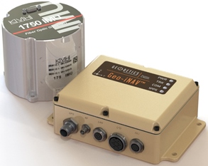
April 17, 2014 KVH Precision Sensors Chosen by Geodetics for Inertial Navigation Systems By GPS World Staff