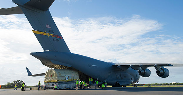
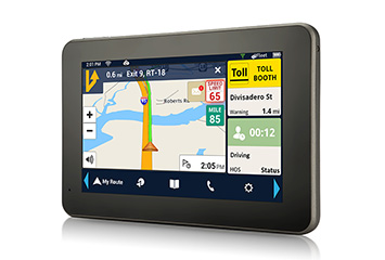
Skip to content

Archives

Topcon YieldTrakk Monitors Yields

October 15, 2015 - By

Topcon Precision Agriculture has expanded its precision agriculture line of solutions to include a new yield monitoring system — YieldTrakk. YieldTrakk is an optical sensing, volumetric solution designed to provide operators with the real-time data collection needed to make intelligent business decisions in the combine cab and afterward. It includes monitoring and mapping of yield (in bushels or tonnes), moisture and cut... read more

This is posted in Latest News, Machine Control/Ag

Baseband Technologies Granted Patent for Ultra Low-Power GPS Receiver

October 15, 2015 - By

Baseband Technologies Inc. has been issued a patent from the United States Patent and Trademark Office for its low-power satellite positioning innovation. U.S. Patent No. 9,116,234, titled “System, Method and Computer Program for a Low Power and Low Cost GNSS Receiver,” describes the technology and processes to significantly reduce the energy required to operate a GPS receiver. Baseband’s ultra low-power GPS receiver... read more

This article is tagged with , , , and posted in Latest News, Mobile, OEM

Topcon Secures FAA Exemption to Operate Rotary-Wing Aerial System in U.S. 

October 15, 2015 - By

Topcon Positioning Group has received a Section 333 exemption from the Federal Aviation Administration (FAA) that allows for operation of its Falcon 8 rotary-wing unmanned aerial system (UAS) in the United States. The Topcon Falcon 8 — powered by Ascending Technologies — is designed for inspection and monitoring, as well as survey and mapping applications. “Along with our exemption for... read more

This article is tagged with , , , and posted in Featured Stories, Latest News, UAV/UGV

Commercial UAV Expo: Seeking monetizable opportunity

October 15, 2015 - By

It was a very good conference because there were legitimate users and potential users of drone technology. During sessions, the audience was focused, more so than at most conferences I’ve attended. I think the reason is clear. The audience, consisting of drone users, potential users and manufacturers. wants to know where in the rapidly developing drone market is there a chance to make money? read more

This article is tagged with , , , and posted in Featured Stories, GSS Monthly, Lidar, UAS/UAV

2015 Field Technology Conference Registration Opens

October 15, 2015 - By

The Western Forestry and Conservation Association (WFCA) has announced that registration for the Fifth Annual Field Technology Conference (FTC) is open. FTC 2015 is hosted by WFCA, Pacific Northwest Aquatic Monitoring Partnership (PNAMP) and StreamNet. The conference will be held Nov. 18-19 at the Holiday Inn Convention Center in Portland, Ore. The Field Technology Conference offers attendees an insightful look at... read more

This article is tagged with , and posted in GIS News, GIS Software, Lidar, Mapping, Mobile Devices, Technology, UAS/UAV

Mapillary Partners with Esri to Provide Real-Time Street Photos

October 14, 2015 - By

Mapillary, a community-based mapping photo app, is partnering with Esri to help governments and businesses see their cities evolve in real-time through the ArcGIS platform integration. Mapillary creates detailed maps that go beyond street view by instantly stitching together hundreds of thousands of crowd-sourced photos, giving cities the ability to gain insights immediately rather than weeks or months later. The ArcGIS integration provides... read more

This article is tagged with , , , and posted in Featured Stories, GIS News, Mapping

Leica Offers Point-Cloud Workflow Tips in Webinars

October 14, 2015 - By

In two new webinars, Leica Geosystems expert Bill Wallace presents time-saving tips for point-cloud workflows. How to Cut 3D Scanning Project Time Nearly in Half Working with large scanning projects with billions of data points can be a tedious and time-consuming process, often resulting in breaking the project into manageable pieces and duplicating data sets across your organization. However, a new... read more

This article is tagged with , , and posted in GIS News, GIS Software, Technology

GPS SmartSole Launches in Germany for Alzheimer’s Monitoring

October 14, 2015 - By

GTX Corp, an IoT platform in the personal location GPS wearable and wandering-assistive-technology business, has completed a successful SmartSole pilot program transitioning into a commercial launch in Germany. SmartSoles also launched this month in the United Kingdom. GTX Corp has signed a reseller distribution agreement with Way4Net, a solution provider in geo-locating and tracking monitoring services. Way4Net placed its first commercial order,... read more

This article is tagged with , , , , , and posted in Latest News, Mobile