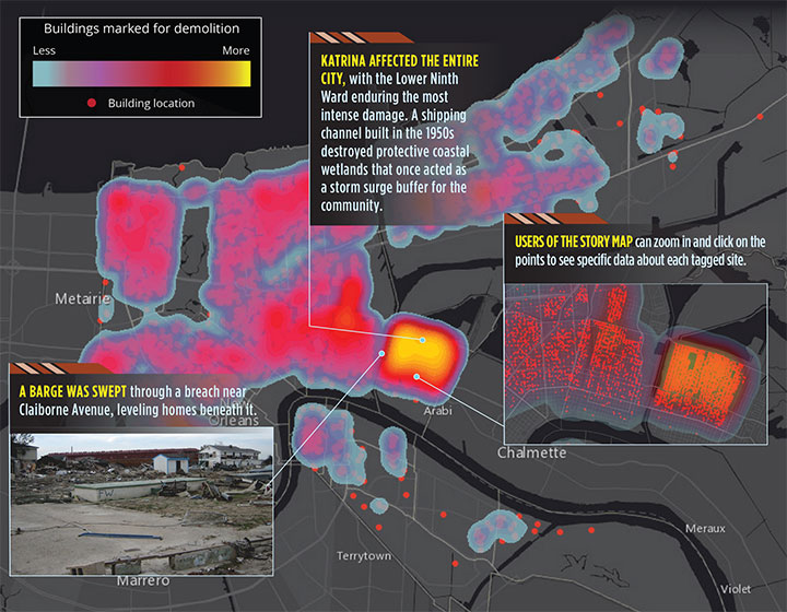
November 13, 2015 Abu Dhabi to host Esri Middle East and North Africa User Conference By Tracy Cozzens
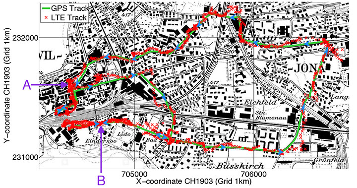
November 12, 2015 UAV real-time: Data use in a lightweight direct georeferencing system By GPS World Staff