August 23, 2016 Geospatial Corporation prepared to meet new federal buried pipeline requirement By Tracy Cozzens
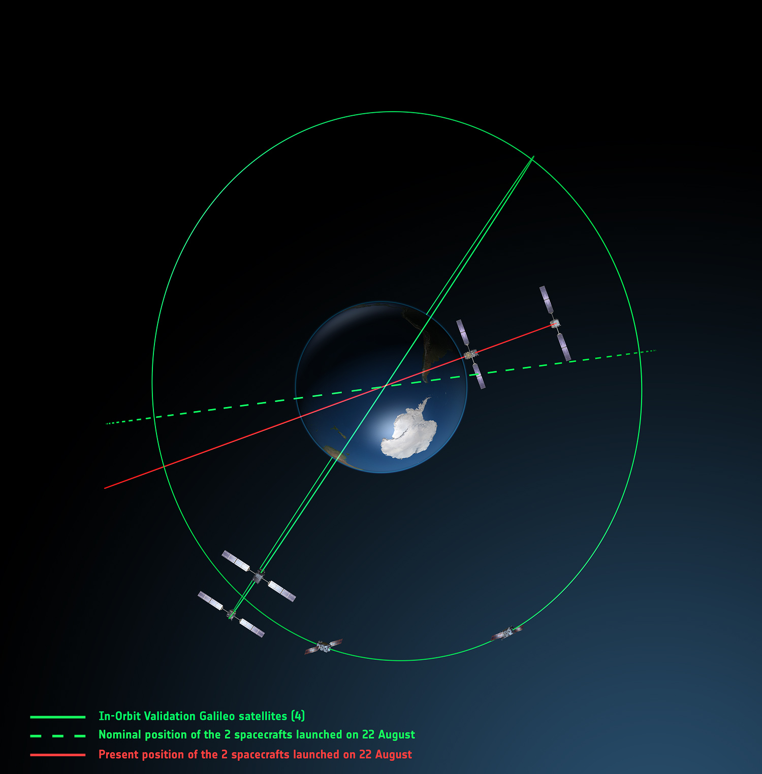
August 23, 2016 System of Systems: Galileo birds active, faulty launch victims still viable By GPS World Staff