August 26, 2019
By Allison Kral
August 23, 2019
By Tracy Cozzens
August 22, 2019
August 21, 2019
By GPS World Staff
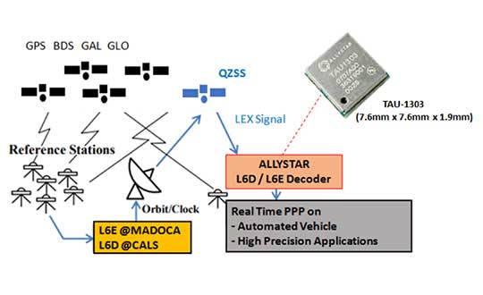
By Tony Murfin
August 20, 2019
August 16, 2019
By Bethany Chambers
January-February 2026
October 2025
September 2025
June 2025
May 2025
April 2025
March 2025
February 2025
January 2025
December 2024
See All Results