November 21, 2019 Pointfuse launches simple BIM solution for facilities management By GPS World Staff
November 21, 2019 Pointfuse launches simple BIM solution for facilities management By GPS World Staff
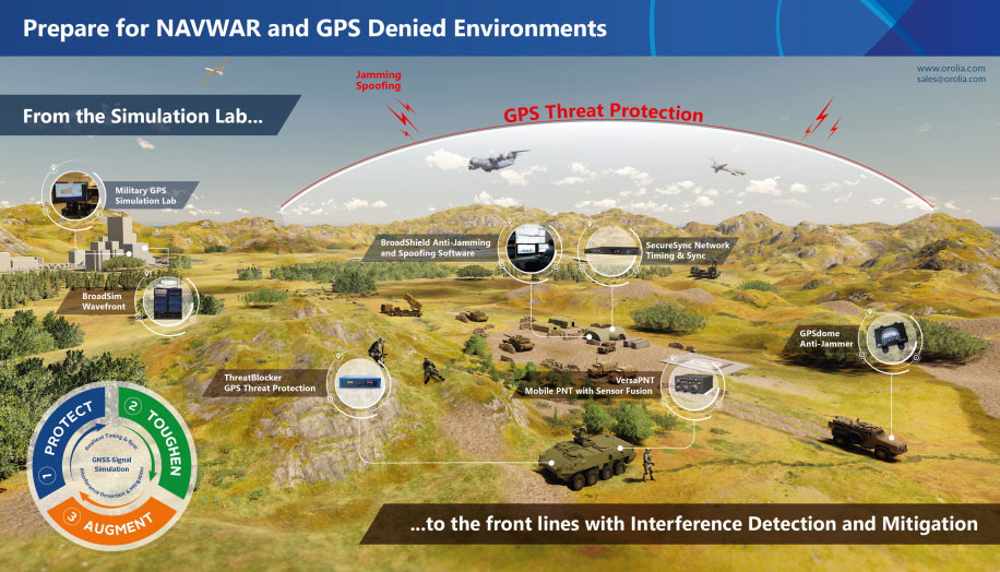
November 21, 2019 Demand rises for defense solutions in NAVWAR and GPS-denied environments By GPS World Staff