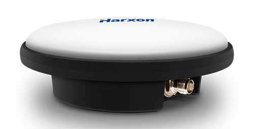
Skip to content

Archives

Geospatial Solutions coverage of COVID-19

May 14, 2020 - By

Geospatial Solutions and GPS World are offering the latest news and updates concerning the coronavirus (COVID-19) pandemic as it affects the geospatial, mapping and GNSS/PNT industries. Read a message from GPS World here. NEWS • GMV leads development of ESA COVID-19 Space Hunting Platformy (7/20/20) • How is COVID-19 affecting you? Take part in our survey (4/22/20) • US small business... read more

SDSN Trends releases gridded population data report

May 13, 2020 - By

The Sustainable Development Solutions Network’s (SDSN) Trends (Thematic Research Network on Data and Statistics) has released a new report, titled “Leaving No One Off the Map: A Guide for Gridded Population Data for Sustainable Development.” According to SDSN Trends, gridded population data have emerged as an important resource for delivering actionable data in challenging circumstances, including in disaster response and... read more

5th annual FAA UAS Symposium goes virtual because of COVID-19

May 13, 2020 - By

The Federal Aviation Administration (FAA) and the Association for Unmanned Vehicle Systems International (AUVSI) will host the 5th annual FAA UAS Symposium virtually, rather than in-person in Baltimore. The event will take place June 16-18. This decision was made as a result of the ongoing concerns caused by the COVID-19 pandemic, the organizers said. The FAA and AUVSI also will... read more

This article is tagged with , , and posted in COVID-19, Latest News, UAV/UGV

Altitude Angel releases Scout, an open-source remote ID platform 

May 13, 2020 - By

Altitude Angel, a London, U.K.-based unmanned traffic management (UTM) technology provider, is releasing an open-sourced project, Scout. Scout’s hardware and firmware enable drone manufacturers, software developers and commercial drone pilots to quickly connect to its global UTM. Primarily intended for use in commercial and industrial drone applications, Scout provides the capability to securely obtain and broadcast a form of network... read more

NavVis launches VLX wearable mapping system

May 13, 2020 - By

NavVis has launched NavVis VLX, a wearable mapping system that captures high-quality data in built environments such as construction sites, staircases and small technical rooms. The all-in-one reality capture capabilities of NavVis VLX include both survey-grade point clouds and high-resolution panoramas. The combination of high-quality data capture and a compact, economical design will transform the way architecture, engineering and construction... read more

ION to host webinar on sample correlation on SISRE overbound for ARAIM

May 13, 2020 - By

The Institute of Navigation (ION) will be hosting a complimentary webinar, “Impact of Sample Correlation on SISRE Overbound for ARAIM,” at 12 p.m. ET on May 28. This topic was originally presented at ION GNSS+ 2018 and published in the Spring 2020 issue of Navigation, Journal of the Institute of Navigation, Volume 67, No. 1, pp 197-212, by Dr. Santiago... read more

Veripos offers LD900 quad-band GNSS receiver for marine environments

May 13, 2020 - By

Veripos has released the LD900, a quad-band GNSS receiver capable of tracking GPS, GLONASS, BeiDou, Galileo and QZSS constellations to provide reliable and accurate positioning. Access to multiple GNSS signals allow for better satellite availability and reduce the impact of satellite masking or blockage, which can affect positioning. LD900 also receives L-band signals on multiple channels, providing access to the... read more

At-home crowdsourcing and citizen science for mapping enthusiasts

May 13, 2020 - By

The world so close has never seemed so far away. Locked up and adrift, somewhere between the comfort of the past and the anxiety of the future, the present slowly passes by in a procession of nameless days. The living room has become a sundial. Shadows pass from one wall in the morning to the far side by day’s end.... read more