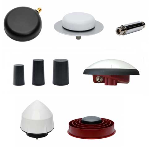
Skip to content

Archives

Harxon debuts ruggedized antenna HX-CVX600A for i-construction machining applications

May 12, 2020 - By

Harxon has launched a ruggedized GNSS antenna for applications subject to high shock and vibration environments such as i-construction machining applications. Integrated with reliable signal tracking and strong anti-interference performance, the IP69K ruggedized HX-CVX600A antenna provides end users with millimeter accuracy, durability and productivity, the company said. I-construction promotes the use of automated machines on construction sites to improve productivity... read more

GSA, European Commission leverage Sixfold expertise to develop Galileo Green Lane app

May 12, 2020 - By

The European GNSS Agency (GSA) has collaborated with the European Commission to develop the Galileo Green Lane app, a mobile solution designed to facilitate the free movement of freight, reduce waiting times at European Union (EU) borders and prioritize essential goods during the COVID-19 pandemic response. According to GSA, for border control authorities, the app provides a real-time visualization of... read more

Ruptela expands to US with new telematics tracker, platform

May 12, 2020 - By

Fast-growing European transport telematics company Ruptela has expanded its global presence to the United States with a tailored ready-to-use telematics solution, the Trace 5 GPS tracker and multifunctional fleet management platform TrustTrack. The Trace 5 plug-and-play GPS-based automatic vehicle location (AVL) tracker has LTE Cat M1 (4G) connectivity and an integrated battery. It is fully certified according to North American... read more

Will Britain launch its own Galileo? Maybe not

May 12, 2020 - By

When Brexit happened, many in Britain thought the country should have its own satellite navigation system, because it was no longer going to be a participant in Galileo, created and run by the European Union. Now the Telegraph reports that officials have concluded that such plans should be scrapped because the £5 billion project would be a waste of taxpayer... read more

This article is tagged with , , and posted in GNSS, Latest News

CHC Navigation introduces Apache3 marine drone

May 11, 2020 - By

Highly cost-effective autonomous marine drone for bathymetric surveys The new Apache3 Marine Drone — 2020 Edition provides a series of new features and additional enhancements to make lake, river and coastal hydrographic surveys more productive, according to maker CHC Navigation. Combining a dual GNSS positioning and heading sensor, a stable and reliable hull attitude and an inertial measurement unit (IMU)... read more

Trimble beta tests new construction OS

May 8, 2020 - By

Trimble WorksOS is an upcoming civil construction software-as-a-service (SaaS) operating system. The cloud-based system will integrate data from Trimble and third-party providers across the entire civil construction project lifecycle, including estimating, scheduling, designs and the field. Beta testing is now taking place for WorksOS, before it is released in the third quarter. Users interested in participating can go to WorksOS.trimble.com.... read more

Esri offers COVID-19 resources for nonprofits

May 8, 2020 - By

Esri will be providing a COVID-19 Response Package for free to all nonprofit organizations responding to the pandemic. According to Esri, this includes data, templates and solutions that are accessible through Esri’s Disaster Response Program. By mapping data with capabilities such as spatial analysis, Esri’s software allows organizations to track where COVID-19 cases are spreading, and — through predictive modeling... read more

SPH Engineering announces bathymetric drone solution

May 7, 2020 - By

SPH Engineering has launched a new product to make bathymetric surveys of inland and coastal water. The system — an unmanned aerial vehicle (UAV) integrated with an echo sounder — is time- and cost-efficient. It is suitable for mapping, measuring and inspecting tasks as well as environmental monitoring. The system allows field workers to collect data with high accuracy quickly.... read more