July 14, 2020 Raytheon’s StormBreaker completes first guided release in U.S. Navy flight test By Allison Kral
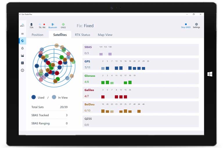
July 13, 2020 Eos Positioning announces new high-accuracy GNSS releases at 2020 Esri UC By Tracy Cozzens