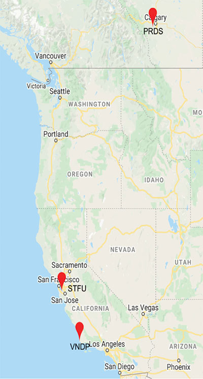
Skip to content

Archives

European project researches automated map creation for cars

August 6, 2021 - By

A new European project is researching automated collection of geodata and production of high-definition maps. The GAMMS project is funded by the European Union Agency for the Space Programme (EUSPA), and will take place until the end of 2023. Galileo will be the main enabler of GAMMS, given its precise, multipath-resistant measurements and its upcoming high-accuracy service (HAS). A European... read more

Masten to develop beacon navigation system for the Moon

August 6, 2021 - By

Masten Space Systems has been awarded a U.S. Air Force contract to develop and demonstrate a lunar positioning and navigation network prototype that functions much like GPS. The Phase II Small Business Innovation Research (SBIR) contract was awarded through the Air Force Research Laboratory’s AFWERX program. AFWERX connects innovators across government, industry and academia. The navigation network will enhance cislunar... read more

John Deere acquires Bear Flag Robotics to accelerate autonomous farm tech

August 6, 2021 - By

Deere & Company has signed a definitive agreement to acquire Bear Flag Robotics for $250 million USD. Founded in 2017, Bear Flag is a Silicon Valley-based startup that develops autonomous-driving technology compatible with existing machines. The deal accelerates the development and delivery of automation and autonomy on the farm and supports John Deere’s long-term strategy to create smarter machines with... read more

US Space Force to host GPS document forum

August 6, 2021 - By

The U.S. Space Force will host the 2021 Public Interface Control Working Group and Open Forum in September and November. The meetings are open to the public in person and virtually on Wednesday, Sept. 29, 8:30 a.m. to 4 p.m., and Tuesday, Nov. 19, 8 a.m. to 4 p.m. (Pacific Time). The meeting and forums will discuss the following documents:... read more

India seeks global adoption of its NavIC system

August 5, 2021 - By

A new draft policy in India seeks to foster global use of its Indian NavIC satellite navigation system. The draft Indian Satellite Navigation Policy 2021 (SATNAV Policy 2021) is part of reforms of the Indian Space Research Organisation (ISRO)/Department of Space (DoS). “ISRO/DOS shall work towards expanding the coverage from regional to global to ensure availability of [the] NavIC standalone... read more

This article is tagged with , , , , , and posted in GNSS, Latest News

Parrot, Verizon and Skyward bring 4G-connected drone to US

August 5, 2021 - By

The Parrot ANAFI Ai is powered by Verizon 4G LTE and integrated with Skyward software to pave the way for near real-time data transfer, remote deployment and beyond-visual-line-of-sight (BVLOS) flight operations. Verizon, Parrot and Skyward have entered a partnership to bring an out-of-the-box 4G LTE connected drone to the United States. The Parrot ANAFI Ai is an off-the-shelf drone that... read more

WingtraOne GEN II debuts for professional VTOL flights

August 5, 2021 - By

A new vertical-takeoff-and-landing (VTOL) drone — the WingtraOne GEN II — is now available. The GEN II offers industrial reliability and mapping versatility with an oblique camera configuration for high-quality 3D drone-mapping data capture. Drone maker Wingtra spent six years developing the GEN II, and tested it over 100,000 flights. Its WingtraOne is being used by professionals worldwide across many... read more

uAvionix receives FAA order for certified drone GPS receiver

August 5, 2021 - By

uAvionix Corp. has received a Technical Standard Order (TSO) from the U.S. Federal Aviation Administration (FAA) for its truFYX GPS receiver for unmanned aircraft systems (UAS). Capable of receiving satellite-based augmentation system (SBAS) and wide area augmentation system signals, the receiver specifically targets UAS platform navigation and surveillance solutions. With an increased regulatory focus on certifiability of UAS for beyond... read more