No audio available for this content.
As digital producer for Geospatial Solutions, I spent three days this month covering Unmanned Systems 2015, the huge show hosted by the Association for Unmanned Vehicle Systems International (AUVSI). This was definitely the show at which I gathered the most news and footage of exciting UAV/UAS applications in geospatial technology.

Let’s meet the experts responsible for developing high-altitude color and infrared imagery gathering of a city-sized area, a lower altitude quadcopter for surveying and mapping and a small vertical take-off and landing aircraft developed for use by warfighters that is now ready for first responders and others in small, cluttered, urban environments, giving them an eye-in-the-sky in just minutes.
From the chipset level to fully-featured aerial survey platforms to processing software, AUVSI had it all.
Intro to AUVSI’s Unmanned Systems 2015
The Association for Unmanned Vehicle Systems International’s (AUVSI’s) Unmanned Systems 2015 show, held May 4-7 in Atlanta, convened a global community of commercial and defense leaders in intelligent robotics, drones and unmanned systems.
CEA Research: UAS Could Reach 1M U.S. Flights a Day in 20 Years
The United States will reach one million UAS flights per day within the next 20 years, given the right regulatory environment, according to new economic research from the Consumer Electronics Association.
Exelis Showcases CorvusEye at AUVSI 2015
CorvusEye 1500 is one of the programs Exelis featured at AUVSI 2015. From an altitude of 15,000 feet, CorvusEye 1500 provides color and infrared imagery of a city-sized area unavailable with comparable airborne systems. Bernard Brower, product manager for Exelis, shows us how users work with the real-time analytics and processed data to search for vehicle tracks based on location and time.
Trimble Details New OEM Module at AUVSI 2015
Akshay Bandiwdekar of Trimble Integrated Technologies details the company’s BD935-INS module that features precision GNSS with an integrated 3-D Micro-Electro-Mechanical Systems (MEMS) inertial sensor package. As part of Trimble’s GNSS OEM portfolio, the new compact module augments real-time precise positioning with 3-D orientation.
Septentrio Launches AsteRx-m UAS Reciever at AUVSI Show
Septentrio’s Jan Van Hees talks about the AsteRx-m UAS, an RTK-accurate GNSS receiver solution specially designed for the drone market. The AsteRx-m UAS provides high-accuracy GNSS positioning with low power consumption, according to Septentrio.
NavtechGPS Showcases GPS, GNSS Products for Unmanned Systems
NavtechGPS CTO Franck Boynton explains how AUVSI 2015 attendees can incorporate GPS and GNSS technology into unmanned projects. NavtechGPS represents nearly 30 leading manufacturers of GPS and GNSS products.
NovAtel Showcases FlexPak6, FlexPak-S Receivers
NovAtel’s Peter Soar talks about the company’s FlexPak6 receiver that houses its OEM628 triple-frequency plus L-Band GNSS receiver board. It has a highly configurable interface to ensure precise positioning for UAV applications. Soar explains that its “sister unit,” the FlexPak-S, contains a real-time kinematic GPS receiver with an L-3 XFACTOR Selective Availability Anti Spoofing Module (SAASM). The two receivers are both the same size and fit.
Lockheed Martin Displays K-MAX Cargo UAS Helicopter at AUVSI Show
Lockheed Martin Corporation and Kaman Aerospace Corporation transformed Kaman’s K-MAX power lift helicopter into an unmanned aircraft system capable of autonomous or remote controlled cargo delivery. Jon McMillen explains that its mission for the last three years has been to resupply battlefield cargo for the U.S. military in Afghanistan. McMillen says another possible application for K-MAX is firefighting.
NavCom Technology Offers Navigation and Positioning Capabilities for UAS
NavCom Technology’s Jim Williams explains the precise positioning and navigation solutions offered by the company for UAS. NavCom offers GNSS aerial antennas, RTK positioning and its StarFire global satellite-based augmentation system (GSBAS).
Maxtena Displays L1/L2 GPS Antennas for Use in UAS
Stani Licul, CEO of Maxena, displays some of its antennas for use in UAS. Maxtena’s active rugged antenna is designed for L1/L2 GPS and GLONASS bands for GNSS satellite and RTK applications.
Spirent Federal Systems GSS9000 GPS/GNSS Constellation Simulator
Jeff Martin of Spirent Federal Systems talks about how its GSS9000 simulator can help with UAS development. The GSS9000 simulator supports multi-system, multi-constellation GNSS testing for UAS.
NovAtel Talks GPS Anti-Jam Technology for Use in UAVs
NovAtel’s Peter Soar shares on the company’s GAJT (“Gadget”), a single unit GPS anti-jam antenna for use in UAVs. GAJT nullifies jammers, ensuring satellite signals necessary to compute position and time are always available.
Exelis Disruptor SRx Electronic Warfare Technology Explained
Marty Apa, chief engineer for Exelis’ Integrated Electronic Warfare Systems, shows Geospatial Solutions the Disruptor SRx. The Disruptor SRx electronic warfare technology is small enough to fit into UAS. It also has the ability to switch between multiple functions in real time.
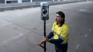
Geomatics USA’s GPS Technology Enables UAS Navigation
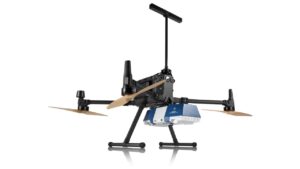
Geomatics USA’s Ahmed Mohamed showcases a UAS that uses the company’s GPS technology to take off and land quadcopters from its structure. Geomatics USA also offers its G-AT: Active Target for surveying and mapping.
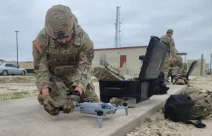
Lockheed Martin Corporation Demos Indago UAS at AUVSI Show
Lockheed Martin demonstrates its Indago UAS. The Indago payload system features a quick disconnect adapter which allows the operator to choose the appropriate payload for the mission, according to Lockheed Martin. The payloads are available for a variety of different applications, including agricultural, mapping, inspection and ISR.
Exelis’ Symphony RangeVue Offers Web-Hosted Aircraft Surveillance Information
Christian Ramsey, UAS program manager for Exelis, explains that the Symphony RangeVue enables UAS operators and test-range personnel to have access to both real-time and historical aircraft surveillance information via a web-hosted platform, helping to manage mission operations across multiple locations. Symphony RangeVue can be used as command center decision support and post-event analysis tool, or in the field as a sense-and-avoid addition to UAS ground control stations. Flexible geofencing tools alert operators when a UAS approaches airspace boundaries or other aircraft are in the vicinity.
Spectracom Shows Off Rugged Product Line at AUVSI Show
Spectracom displayed its precise positioning, navigation and timing solutions that leverage GPS/GNSS signals at AUVSI 2015. Capabilities for unmanned aerial systems (UAS) include precision references, signal generation, reception, synchronization, distribution, test/validation, simulation, integration, interference, detection/mitigation, real-time embedded and technical/support services.
Racelogic Highlights GNSS Simulator, VBOX Speed Sensor IMU
Jim Lau with Racelogic details the company’s GNSS Simulator and VBOX Speed Sensor IMU. VOBX is a 100-Hz dual-antenna GPS/GLONASS speed sensor (VBSSISL) that combines signals from an integrated inertial measurement unit with those from GPS to provide smoother output data even when satellite reception is interrupted.
Next year’s show has been branded XPONENTIAL 2016, “An AUVSI Experience,” and will be held in New Orleans, May 2–5. See you there!