Listen to this content
My January 2025 GPS World newsletter mentioned that the National Geodetic Survey (NGS) made several updates to the North American-Pacific Geopotential Datum of 2022 (NAPGD2022) products and that these updates are now available on the NGS alpha site. NGS held a webinar on Jan. 9, 2025, to discuss NAPGD2022 and explain the product updates. I highlighted the NGS Alpha site and GEOID2022 — a product of the NAPGD2022 — in my July 2024 newsletter.
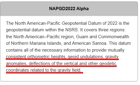
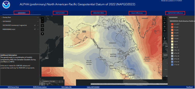
This newsletter will highlight the NAPGD2022 alpha site and the components on the Alpha site — GEOID2022, DEFLEC2022, DEM2022 and GRAV2022. See below for a description of the site.
NGS users of the new National Spatial Reference System (NSRS) should determine the impact on their products and services. For example, the effect of using NAPGD2022 orthometric heights instead of the North American Vertical Datum of 1988 (NAVD 88) on flood plain maps and FEMA elevation certificates.
I have experience dealing with the impact of products and services changing from one national vertical datum to another. When I worked for NGS, I was the Project Manager of NAVD 88. The adjusted heights from the NAVD 88 general adjustment were officially published on June 15, 1991. Performing the adjustment of NAVD 88 was a relatively simple task compared to implementing of NAVD 88 in geospatial products and services in the United States. I wrote articles and talked about the change in the datum from the National Geodetic Vertical Datum of 1929 (NGVD 29) to NAVD 88 at surveying and mapping conferences several times a year during the decade before the completion of the adjustment. Many users were still surprised by the change and the impact on their products and services. It’s a little different today because there are more ways of getting the word out in today’s digital world, such as webinars, Zoom meetings and digital magazines. That said, users still need to participate in webinars and Zoom meetings and read digital articles to understand the changes to geospatial products and services.
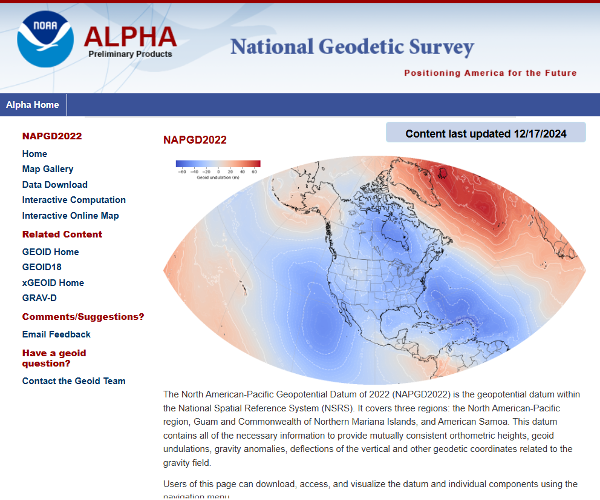
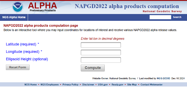
The NAPGD2022 alpha site can be accessed here.
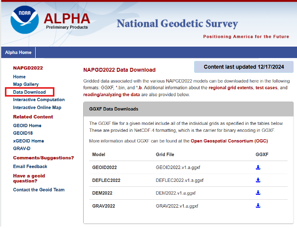
Users can download gridded files of the models to create their own routines to analyze the models in their region.
The site provides an option for users to perform single point interactive computations.
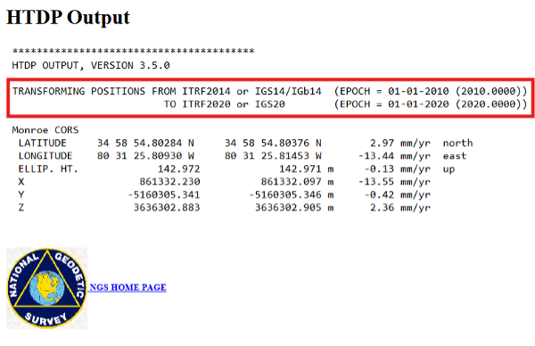
The differences between the ITRF 2014 (epoch 2010.0) coordinate and ITRF 2020 (epoch 2020.0) in North Carolina are not very large. Still, I used NGS’s HTDP tool to transform the North Carolina Monroe CORS (NCMR) ITRF 2014 (epoch 2010.0) coordinates to ITRF 2020 (epoch 2020.0) and then entered the transformed values into the interactive tool. See the images “HTDP Output for NCMR” and “Interactive Computation Page” for an example of the output of the single-point interactive computation tool.
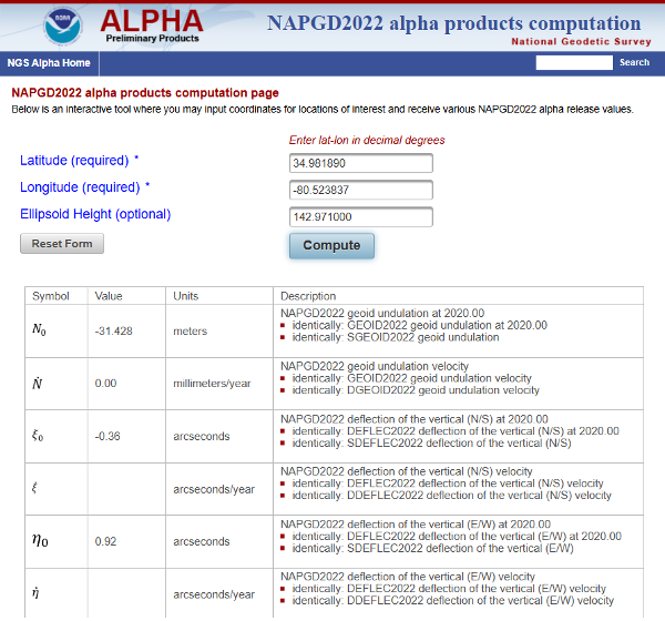
I have highlighted the NAPGD2022 orthometric and dynamic heights for NCMR CORS. I downloaded the latest NGS datasheet for the North Carolina Monroe CORS (NCMR) to obtain the published NAVD 88 height. See the image below.
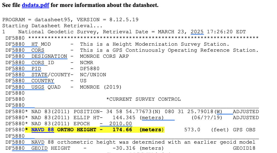
In my example, the difference between the NAPGD2022 and NAVD 88 orthometric height is -0.26 meters (174.40 m – 174.66 m). It should be noted that the tool also provides a dynamic height for the mark. Dynamic heights are used by the International Great Lakes Datum (IGLD). My August 2021 GPS World Newsletter provides more information on the update to the IGLD 85 and dynamic heights. The interactive computation page tool also provides the GEOD2022 value for the mark. The difference between GEOID2022 and GEOID18 for the mark is -0.112 meters (-31.428 minus -30.316).
The alpha site provides an option to use an interactive online map that allows users to access GIS maps that depict individual models. I have highlighted the five layers on the box titled “NAPGD2022 Interactive Online Map” – GEOID2022, SDEFLEC2022, GRAV2022 (RBA), Geoid Differences, and NAPGD2022 Differences.
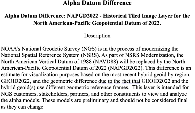
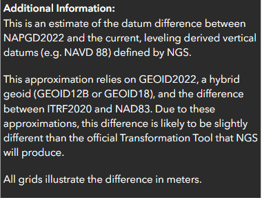
To demonstrate the online maps, I clicked on the layer titled “NAPGD2022 Difference” located in the upper right corner of the of the map. The image below provides a description of the layer.
Users can click on the map, and the pop-up provides information about the location. In the example below, the popup provides the difference between the NAPGD2022 orthometric height and the NAVD 88 height.
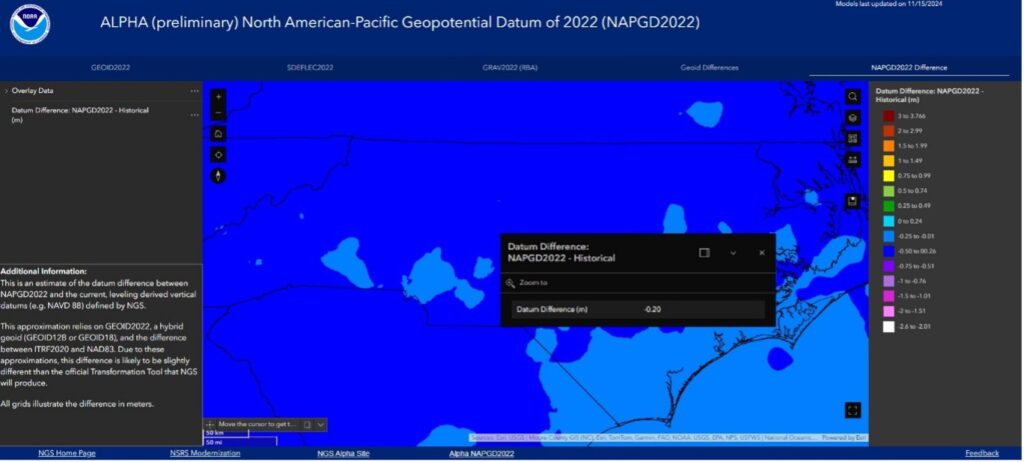
Additional information about a layer is provided on the lower left side of the map page.
NGS’ online maps didn’t depict the details I wanted to visualize, so I downloaded the data and created my own maps.
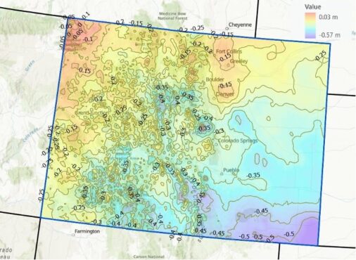
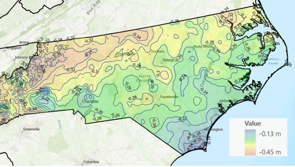
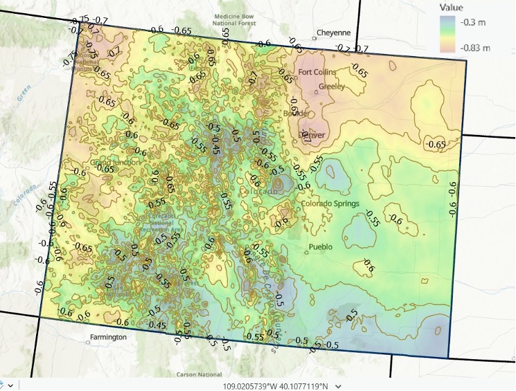
I provided a couple of examples of the differences between NAPGD2022 and NAVD 88 below: one for North Carolina and one for Colorado. As you can see from the plots, there are significant relative differences in mountainous regions (western North Carolina and western Colorado), and a lot of local variation across the state.
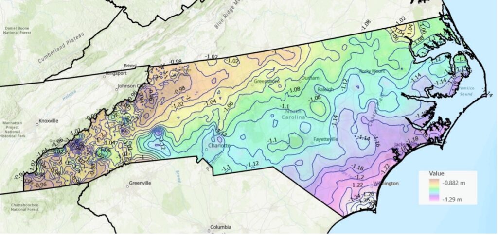
I used the same process to determine the differences between GEOID2022 and GEOID18. See the images titled “Differences between GEOID2022 and GEOID18 in North Carolina” and “Differences between GEOID 2022 and GEOID 18 in Colorado.” Again, it should be noted that there is a lot of variation across the state.

In summary, in a few months, NGS will be releasing a Beta version of the new terrestrial reference frames and geopotential datum. This newsletter highlighted the NAPGD2022 alpha site and the components on the Alpha site — GEOID2022, DEFLEC2022, DEM2022, and GRAV2022. I did a 4-part series in my GPS World newsletters in 2017 on the products of NAPGD2022 (June 2017, August 2017, October 2017 and December 2017).
NGS’s Jan. 9, 2025, webinar discussed the North American-Pacific Geopotential Datum of 2022 (NAPGD2022) Alpha website and explained the recent product updates. I would encourage users to download the video and presentation for more details. Now is the time for surveyors to learn about the new, modernized National Spatial Reference System. NGS publicly given presentations collected for public viewing can be downloaded from the following website: https://geodesy.noaa.gov/web/science_edu/presentations_library/.