Listen to this content
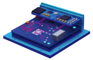
Balboa Geo, in partnership with the Texas A&M Engineering Extension Service (TEEX) and the George H.W. Bush Combat Development Complex (BCDC), completed a rigorous field testing campaign of its POINTER system, a “dual-use,” real-time alternative positioning, navigation and timing (A-PNT) technology designed for GPS-denied, degraded and disrupted environments, including indoor, subterranean and obstructed urban settings.
The POINTER field test plan, led by Balboa Geo’s Andrew Aubrey, Ph.D., with technical support from TEEX and Texas A&M Professor Stacey Lyle, Ph.D., RPLS, involved 130 tests across seven challenging testing and training venues located at TEEX and the BCDC.
Test venues included:
- A three-story concrete structure with 10-inch-thick, rebar-reinforced concrete walls
- A compartmentalized steel-hulled ship with three decks reaching approximately 25 ft high
- A steel shipping container (CONEX)
- A simulated collapsed structure and rubble pile composed of steel, concrete, and a 90° tunnel network
- A simulated industrial oil refinery with processing equipment and complex, elevated steel piping
- A six-story steel training tower with metallic siding throughout
- The BCDC military-grade subterranean tunnel network, featuring a main tunnel at about 10 ft deep and a heavily shielded segment with Faraday cage properties simulating greater depth
Rigorous test design and real-time A-PNT data collection
The POINTER field test plan deployed a Base Station Laptop (BX) and a single Transmitter (TX) emitting an omni-directional Magneto-Quasistatic (MQS) field outside each venue. Two Receivers (RX) were introduced at various internal locations to capture multiple “XYZ” axis measurements within each GPS-denied setting. Tests were repeated to validate reproducibility, with highly precise measurements taken where possible for ground truth position references.
The BCDC military-grade tunnel network testing consisted of “normal” and “inverted” configurations. The “inverted” test consisted of placing the TX at depth within the tunnel network, with the BX and RX units located externally.
Highlights of the summary results and key findings:
- MQS field penetration and position location were achieved at all seven test venues.
- Real-time, three-dimensional distance measurements were obtained for all 130 tests.
- The mean positional uncertainty across all venues was 12.62 cm.
- Positional uncertainty ranged from 2.5 cm to 36 cm, depending on venue complexity, receiver location, and transmitter-receiver distance.
- Vertical measurements at the concrete structure showed uncertainties as low as 2.5 centimeters at a distance of about 11 m, and up to 24 cm at about 30 m.
- The POINTER system demonstrated penetration into and out of the BCDC military-grade tunnel network, including the shielded portion, indicating flexibility and performance in challenging subterranean environments.