Listen to this content
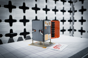
GMV has presented the latest results from its Enabling High-Performance PNT in the Lunar Environment (LUPIN) project, following a series of field tests conducted from April 27 to May 8 in La Oliva, on the Spanish island of Fuerteventura. The LUPIN initiative, developed in collaboration with the European Space Agency (ESA), aims to create a prototype navigation system that simulates the signals lunar surface rovers are expected to receive in the future. The goal is to establish a navigation system for the Moon similar to GPS on Earth, enabling more precise and reliable positioning for lunar missions.
As renewed interest in lunar exploration grows, the need for advanced technologies to support rovers, landers and potential human activities on the Moon has become a strategic priority for the space sector. ESA is pursuing this project under its Navigation Innovation and Support Program (NAVISP), seeking to test new positioning, navigation and timing (PNT) technologies. These technologies will integrate current planetary navigation approaches with distance measurement signals from the future Lunar Communication Navigation System (LCNS), a network of satellites orbiting the Moon that will provide GPS-like signals to the lunar surface. The system is being designed to serve specific lunar regions, including the south pole, the far side and permanently shadowed areas.
Navigation on the Moon currently faces significant challenges. Unlike Earth, the Moon lacks a satellite infrastructure like GPS, forcing spacecraft and rovers to rely on internal calculations and data relayed from Earth, which limits real-time location accuracy. The LUPIN prototype aims to address these limitations by reducing dependence on complex onboard algorithms and optimizing the performance of lunar exploration vehicles. Over the next decade, this technology is expected to transform how astronauts and vehicles operate on the lunar surface, enabling faster and more efficient route planning and reducing the computational burden required for navigation. This advancement means rover speeds will be limited only by lunar surface conditions, not technical constraints, potentially ushering in a new era of automated lunar exploration.
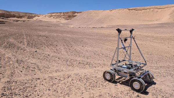
During the recent test campaign in Fuerteventura, the LUPIN system’s real-time navigation capabilities were successfully verified and validated. The tests simulated the LCNS positioning signals that future lunar rovers will use to determine their exact location. Steven Kay, GMV’s manager for the LUPIN project, explained the field tests performed and the corresponding details.
“We were able to successfully compile data over the course of 7 km of travel, and at various speeds, from the conventional 0.2 m per second, up to much faster speeds of 1.0 meters per second, which are the speeds of the future. In addition, we were able to simulate a whole range of lunar conditions and types of environments. This included tests performed at night, using a combination of simulated sunlight to emulate the illumination conditions found on the Moon, as well as tests performed in total darkness, using only the rover’s onboard lighting system to navigate,” Kay said.
The LUPIN project is part of broader efforts by ESA and its partners to develop lunar communication and navigation services, which are seen as essential for future scientific, commercial and human activities on the Moon