Listen to this content
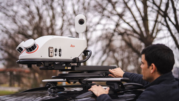
Leica Geosystems, part of Hexagon, has launched the Leica Pegasus TRK300, designed for various mobile mapping applications. As mobile mapping becomes increasingly important for collecting geospatial data, the technology supports smart city projects, infrastructure development and digital twin creation, improving urban planning and operational efficiency across industries.
With this new system, users with varying levels of experience can efficiently capture high-quality point cloud data. “The Pegasus TRK300 opens exciting opportunities for any business looking to enhance and grow their mapping capabilities, from identifying potholes to optimizing city center traffic flows,” says Christian Schäfer, business director mobile mapping at Leica Geosystems. “Because it is lightweight and designed with the user in mind, a single person can easily transport it and mount it to a vehicle, delivering results with minimal effort.”
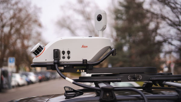
The Pegasus TRK300 features a multi-beam scanner system with two scanning heads that quickly collect high-resolution data from multiple angles, minimizing data gaps. With a range of up to 300 meters, the system covers wide corridors and large open areas, reducing the need for multiple passes. This capability allows users to map more ground in less time without sacrificing data quality, resulting in a high-density point cloud suitable for asset mapping and smart city modeling.
The Pegasus TRK300’s robust design allows it to operate in challenging conditions, including heavy rain and dust. Its seven-hour battery life supports a full day of fieldwork without frequent battery changes. The system complements the Pegasus TRK portfolio by offering a portable solution that balances advanced data capture with ease of use.
The Pegasus TRK300 integrates with Leica Pegasus FIELD for data capture and system monitoring and with Leica Pegasus OFFICE for advanced post-processing and final deliverables. This integration seeks to streamline workflows for mapping infrastructure, streets and assets, eliminating complicated file conversions or compatibility issues.