No audio available for this content.
Achieve Precision with GEODNET’s Cost-Effective, RTK Global Network

What is RTK (Real-Time Kinematic)?
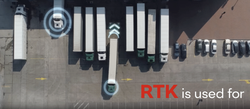
RTK (Real-Time Kinematic) is a satellite navigation technique that improves standard GPS accuracy from a few meters down to just a few centimeters. It works by using a nearby base station—a fixed GPS receiver at a known location—that sends real-time correction data to a mobile GPS device (called a rover). This enables high-precision positioning for applications like land surveying, robotics, autonomous vehicles, and precision agriculture.
GEODNET’s RTK Network: The Largest and Most Affordable
GEODNET is the largest RTK network globally, with over 18,500 base stations deployed around the world. This expansive network ensures that no matter where you are, high- precision GPS data is always within reach. GEODNET’s network is not only the most extensive, but also the most cost-efficient, offering a solution at a fraction of the price compared to other RTK service providers without compromising reliability.
The affordability and scale of our network make it the ideal choice for industries requiring continuous access to precise location data, from agriculture to construction and beyond.
Applications of RTK Technology
In land surveying, where accurate mapping is crucial for zoning, boundary determinations, and infrastructure planning, GEODNET’s RTK network provides the reliability and precision required for large and small projects alike. Surveyors can work with confidence, even in remote or difficult-to-reach locations, thanks to our global base station network.
For robotics, the precision of GEODNET’s RTK technology supports autonomous vehicles and robotic systems that rely on high-accuracy positioning to navigate complex environments. Our RTK service ensures robots can operate with unparalleled precision, enabling safer and more efficient operations.
In agriculture, RTK technology is revolutionizing farming practices. Autonomous tractors equipped with RTK provide farmers with real-time, high-accuracy data, enabling them to achieve better precision in tasks like planting, irrigation, and pesticide application. This leads to improved crop yields, reduced waste, and more sustainable farming practices.
RTK is vital in fields like emergency response, where UAVs with precise location data are key in search and rescue operations. The ability to quickly and accurately pinpoint emergency locations with RTK technology improves response times and saves lives. RTK also plays a critical role in 3D imaging, enabling drones to capture accurate data for creating precise 3D models of construction sites, buildings, houses, and more.
GEODNET’s RTK network provides the accuracy and reliability needed across a wide range of industries. With global coverage, cost-effective solutions, and the precision required for complex tasks, GEODNET is empowering businesses to work smarter, safer, and more efficiently.
Why Choose GEODNET?
- Cost-Effective: GEODNET’s RTK service is a fraction of the cost of traditional
providers, offering top-notch accuracy at an affordable price. - Global Coverage: With over 18,500 base stations worldwide, GEODNET’s RTK
network ensures that no matter where you are, high-precision GPS data is always
within reach. - Reliability: Our network provides robust, real-time corrections that ensure your
operations run smoothly, no matter the environment.
We understand the cost of RTK services can be a burden for many professionals. That’s why we offer a price matching guarantee. If we can’t offer you a better deal, your first 3 months of GEODNET are on us.
At GEODNET, we’re committed to helping you achieve unparalleled precision in your work. Whether you’re surveying land, navigating drones, or working in construction, our RTK network offers the most reliable and affordable solution on the market.
Ready to experience the benefits of GEODNET’s RTK network? Request a free 30-day NTRIP trial account today and see for yourself how our network can boost your accuracy and save you money.
Click here to learn more about how GEODNET can help optimize your operations with precise, real-time GPS data.
This page was produced by North Coast Media’s content marketing staff in collaboration with GEODNET. NCM Content Marketing connects marketers to audiences and delivers industry trends, business tips and product information. The GPS World editorial staff did not create this content.


