No audio available for this content.
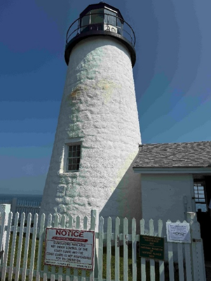
This newsletter is going to highlight some history of the Coast and Geodetic Survey and provide the latest information on the National Geodetic Survey (NGS) new National Spatial Reference System (NSRS). First, every year my brother and I get together and travel to visit friends and relatives. He lives in Montana, and I live in North Carolina, so our yearly trips are typically 10 to 14 days long. As in all trips, I look for geodetic marks along the way. This year we traveled to coastal Maine to visit lighthouses and of course eat lobster rolls. We visited 12 Lighthouses along the Maine Coast. Lighthouses have both historical and navigational importance. The lighthouses were essential in guiding sailors through rocky shores. Portland Head Light commissioned by George Washington in 1791 is Maine’s oldest lighthouse and still guides vessels into Portland Harbor. We found NOS benchmark 841 8031 B 1979 on the grounds of this lighthouse. Pemaquid Point Lighthouse is managed by the Friends of Pemaquid Point Lighthouse, a chapter of the American Lighthouse Foundation, and remains an active aid to navigation under the ownership of the U.S. Coast Guard. We could climb up the Pemaquid Point Lighthouse, so I took a photo of the view from the top.

One of my brother’s requests was to visit the first place in the continental United States to see the sunrise. However, the location of the first place in the continental United States to witness the sunrise depends on the time of year. As indicated in the box titled “First Places to See the Sunrise in the Continental U.S.” Mars Hill is the first place to witness the sunrise in June.


First Places to See the Sunrise in the Continental U.S.
- October 7 to March 6: During these months, Cadillac Mountain in Acadia National Park, Maine, holds the distinction of being the first place in the continental U.S. to see the sunrise. Its elevation of 1,530 feet and eastern location make it ideal for early morning views. reddit.com+10nps.gov+10acadiamagic.com+10
- March 25 to September 18: In the spring and summer, Mars Hill in Aroostook County, Maine, takes the title. Its northeastern position allows it to catch the first rays of sunlight during this period. newengland.com+2en.wikipedia.org+2aa.usno.navy.mil+2
Around the Equinoxes: Approximately during the weeks surrounding the spring and fall equinoxes, West Quoddy Head in Lubec, Maine—the easternmost point of the contiguous U.S.—experiences the nation’s first sunrise. reddit.com+2en.wikipedia.org+2en.wikipedia.org+2
That said, when we travel together, we always recover geodetic marks, so we chose to visit Cadillac Mountain even though in June the first place is located on Mars Hill in Aroostook County.
As many of you know, I worked for NGS for 35 years so reconning monuments is exciting to me. We found six marks in a radius of about two hundred meters on Cadillac Mountain. We will talk about them in a minute.
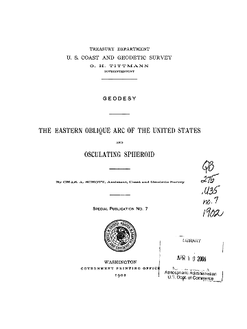
Cadillac Mountain was important to me because from 1833 to 1898, the Coast and Geodetic Survey performed a triangulation project that extended from Calias, Maine, to New Orleans, Louisiana. The project was published as the Eastern Oblique Arc of the United States. The station Mount Desert 1856 that was located on Cadillac Mountain was part of this project. A report published in 1902 describes the Eastern Oblique Arc project and can be downloaded here.
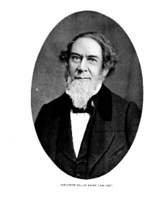
According to the 1902 report, horizontal observations at station Mount Desert 1856 were acquired by Alexander Dallas Bache. That may not mean much to most people, but Mr. Bache was the second superintendent of the Coast Survey and was particularly important to the advancement of geodesy in the United States. As a side note, the Coast Survey was renamed the Coast and Geodetic Survey in 1878. The change reflected the agency’s expanded mission beyond coastal charting to include geodetic surveys of the nation’s interior, prompted by the growing importance of geodesy in its work.
Bache’s leadership of the U.S. Coast Survey
In 1843, Bache was appointed superintendent of the United States Coast Survey, succeeding Ferdinand Rudolph Hassler. Under his leadership, the Coast Survey expanded its missions to include hydrography, geodesy, topography, and the printing arts. He initiated geomagnetic studies, directed tide observers to make meteorological observations, and developed mathematical techniques for tide predictions and adjusting triangulation networks. Bache’s administrative skills transformed the Coast Survey into one of the foremost scientific organizations globally, providing critical data for navigation and commerce.
According to the description of Mount Desert in the 1902 USCGS report, the station was marked by a copper bolt in a ledge (see the box titled “1856 Description of Mount Desert”). The 1902 description of the station on the NGS Datasheet stated that it was a hole drilled in a rock (see the box titled “1902 Description of Mount Desert”). I’m not sure why there is a discrepancy between the two descriptions but in 1931 the Maine Geodetic Survey found the drill hole, and based on measured references to other drill holes in the area that were documented in the original description decided that it was the location of the original station (see the box titled “1931 Description of Mount Desert”). At that time, a Coast and Geodetic Survey Disk with Reference Marks were installed by the Maine Geodetic Survey.


As I previously stated, we found six marks in the area. The boxes titled “Photos of Mount Desert 1856 and Reference Marks” and “Photos of Other Marks on Cadillac Mountain” provide photos of the monuments we found on Cadillac Mountain. One may note that the reference mark 2 monument is in worse shape than the reference mark 1 and the Mount Desert monument. The 1944 recovery note stated that reference mark 2 was covered with roadway stone. There was not any stone covering reference mark 2 when I found it. Reference mark 1 is located behind some trees and out of sight of the path.
When I arrived at the site, there were a group of people looking at reference mark 2. I held a little lecture on the importance of geodetic monuments and how this site was first occupied in 1856; and, of course, I highlighted the importance of geodesy.

I was thrilled to stand in the very spot where Alexander Dallas Bache took geodetic measurements in 1856. [I know—people joke that I need to get a life, all because I get so fired up over geodetic monuments.]
The box titled “Abstract of Observations at Mount Desert” provides a summary of the directions from Mount Desert to the stations involved in this phase of the project. The box also includes a photo of an instrument, a 75 cm theodolite, which was used to perform the observations. The box titled “Diagram of Network Depicting Epping Base Line” provides a diagram that was included in the 1902 USCGS report.
As a side note: during the 1970s as a NGS employee, I personally coded abstracts similar to this one to convert archival data into computer-readable form in support of the North American Datum of 1983 (NAD83) project. Once all data were in computer-readable form, they were reviewed for correctness and combined in an adjustment resulting in what is known as NAD 83 (1986). See the NGS report for some details of the NAD 83 (1986) here.


The other marks we found on Cadillac Mountain included a US Geological Survey Benchmark – K 24 1934, a bent pipe denoted as Cadillac Ground, and a Department of Interior Geological Mark – Cadillac 1975. All these marks are within a 200-meter radius of each other. My understanding is that Cadillac Ground was established because Mount Desert was obstructed by trees. I have provided weblinks for those that would like more information on these marks.

After visiting more lighthouses along the Maine Coast, we traveled back to Boston and visited Waldon Pond and Thoreau’s family home. Why Thoreau you ask? In 2018, the Surveyors Historical Society and NSPS Foundation recognized Thoreau for his work as a surveyor by establishing a commemorative monument at Thoreau’s family farm.
Thoreau described surveying as a “noble employment” that kept him close to nature: “Surveying … brings you within hearing of [the birds]” – https://www.heritagesurveys.com/famous-surveyors. Surveying and geodesy are indeed noble professions; they provide the foundation for all geospatial products and services.

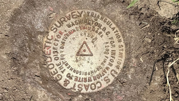
Finally, we left Boston for Syracuse to visit my younger brother and sister. I attended the SUNY College of Environmental Science and Forestry (SUNY ESF) which is immediately adjacent to Syracuse University campus. Both of my brothers attended Syracuse University, so we like to walk around campus whenever we visit Syracuse. During our trip to the University, we recovered the monument Thornden 1934. Thornden 1934 was significant to me because I recovered this monument over 50 years ago, as part of a special project that I performed for my geodesy class.

I hope this was not too boring for you, but I real enjoy history and especially the history of the geodetic network of the United States. Today, you can use modern surveying technology to obtain a more accurate coordinate in seconds where it took days to months in the past. That is amazing!
Now, what is the latest with the modernization of the National Spatial Reference System? On June 17, NGS announced that they incorporated four groups of NSRS modernization products to the NGS beta website.
Multiple NSRS Modernization Products Published to Beta
NGS has released the following four groups of products to the NGS beta website to solicit review and feedback from stakeholders as part of the modernization of the National Spatial Reference System (NSRS): (Note: These products are not final and should not be used for anything other than review and testing.)
North American-Pacific Geopotential Datum of 2022 (NAPGD2022). This datum will replace the North American Vertical Datum of 1988 (NAVD 88) and all other vertical datums for islands in the United States. It will serve as a foundational component of the modernized National Spatial Reference System (NSRS), providing precise definitions for orthometric height (elevation). The release includes the defining grids that collectively make up the datum along with a number of supporting products to visualize the datum.
Products. All NAPGD2022 products are provided as grids for the following: GEOID2022, DEFLEC2022, GRAV2022.
Example coordinates. Coordinates and product values are computed for numerous example points throughout NAPGD2022 and provided in a table. NAPGD2022 Experience. Interactive online maps showing NAPGD2022 products for all regions that can be used on a computer or mobile device to query any location.
Maps of NAPGD2022 products. Static map images of NAPGD2022 products for all regions.New Terrestrial Reference Frames of 2022 for North America (NATRF2022), Pacific (PATRF2022), Caribbean (CATRF2022), and Mariana (MATRF2022) plates. These four geodetic reference frames will replace the North American Datum of 1983 (NAD 83). They will serve as a foundational component of the modernized NSRS, providing precise definitions for geodetic latitude, longitude, and ellipsoidal height.
Euler Pole Parameters of 2022. All of the new terrestrial reference frames are defined by transformation from the International Terrestrial Reference Frame of 2020 (ITRF2020) using Euler Pole Parameters (EPPs) that model tectonic plate rotation.
State Plane Coordinate System of 2022 (SPCS2022). A system of map projections for accessing the modernized NSRS. Zone designs have been incorporated into the following beta products and services:
Zone information tables. SPCS2022 zone definitions, example coordinate computation results, minimum and maximum coordinate values, and minimum coordinate differences with overlapping SPCS2022 zones and with other coordinate systems, provided as interactive tables that can be sorted and filtered.
SPCS2022 Experience. Interactive online maps showing distortion for all SPCS2022 zones that can be used on a computer or mobile device to get distortion at any location or to view zone definitions.
Maps of SPCS2022 zones and distortion. Static map images of SPCS2022 zone layers, number of zones, and distortion with performance statistics.
NGS Coordinate Conversion and Transformation Tool (NCAT). This version can be used to perform SPCS2022 coordinate conversions at any location for all SPCS2022 zones. Later beta versions will include the ability to transform between reference frames and vertical datums.
Products found on the NGS beta website are preliminary releases that are for testing and evaluation only; they are not final products nor do they contain any authoritative NGS data or tools. To provide feedback on any of the content on this site, please email ngs.feedback@noaa.gov.
Everyone should review these products and provide their feedback to NGS. That said, my April 2025 newsletter highlighted the NAPGD2022 Alpha product that was moved to the Beta site. The Beta product is like the Alpha product, but it does not have an option for an interactive computation. The Interactive Computation Option provided essential information about NAPGD2022 and would be helpful to geospatial users for obtaining a better understanding of the differences between NADGP2022 orthometric heights and NAVD 88, and GEOID2022 geoid heights and hybrid GEOID18 geoid heights. My April 2025 newsletter highlighted the interactive computation option.
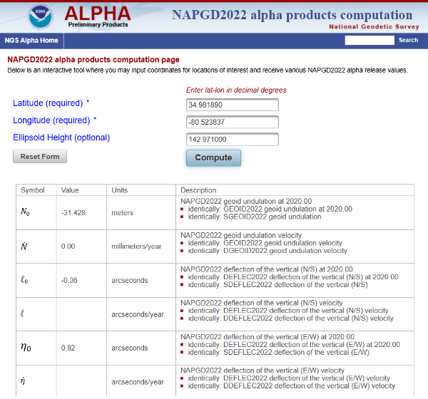
As noted in my April 2025 newsletter, I downloaded the data and created my own maps to better highlight local variations. Although users can still view the original via the interactive online map, this personalized version offers clearer insights.
Here are several of my comments on the Beta products based on my preliminary review:
- The NAPGD2022 difference map (NAPGD2022 minus Historical in meters) uses 25 cm intervals, which are too coarse to reveal the finer local variations between published benchmarks accurately.
- The NAPGD2022 Difference map should have an overlay of the marks used in the creation of the difference map. This would allow users to identify marks in their region of interest. Clicking on a mark should link to the NGS datasheet and Passive Mark Page.
- The beta page for NATRF2022, PATRF2022, CATRF2022, and MATRF2022 is not particularly helpful for everyday geospatial users. There should be an Interactive Computation Option to enter NAD83 (2011), epoch 2010 coordinates where the routine transforms the coordinates into ITRF 2020, epoch 2020, as well as estimates in the new terrestrial reference frames – NATRF2022, CATRF2022, PATRF2022, and MATR2022.
- Both the State Plane Coordinate System of 2022 (SPCS2022) and The NGS Coordinate Conversion and Transformation Tool (NCAT) are good tools for users to obtain an understanding of the differences and changes in the SPCS especially for their State. That said, like above, there should be an option to enter NAD83 (2011), epoch 2010 coordinates where the routine will transform the coordinates into ITRF 2020, epoch 2020, as well as estimates in the new terrestrial reference frames – NATRF2022, CATRF2022, PATRF2022, and MATR2022. The routine does have a note that states users can transform their coordinates using HTDP, but NGS should incorporate this process in the NCAT beta product.
- Note from Beta NCAT product: This beta version of NCAT supports beta State Plane Coordinate System of 2022 (SPCS2022) but not transformations between reference frames or geopotential datums. NAD 83 latitude and longitude can be used as input, but the output coordinates will differ horizontally from actual SPCS2022 by up to a few meters, depending on location (likewise for UTM and USNG). If NAD 83 ellipsoid heights are used, the linear distortion and combined factor will differ from SPCS2022 values by a small amount, within ±0.3 parts per million (ppm). To reduce these differences, NAD83 epoch 2010.0 coordinates can first be transformed to ITRF2020 epoch 2020.0 using the Horizontal Time-Dependent Positioning (HTDP) tool.
I plan to provide these comments to NGS through their feedback email process. Everyone should take time to review these products and provide your feedback to NGS. Remember, NGS placed these four groups of products on the NGS beta website to solicit review and feedback from stakeholders as part of the modernization of the National Spatial Reference System (NSRS) process. Users should review these Beta products and consider two questions:
1. Do these products provide sufficient information and detail for documenting how I will deliver my products and services under the new NSRS?
2. Do I need additional information or tools from the NGS to better understand the changes and impacts of the new NSRS?
Your feedback will help NGS improve the Beta products.
