Austrian team develops navigation system for divers

 Credit: Placebo365 / E+ / Getty Images
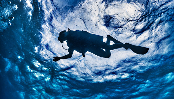
 Buoys located via GNSS and electromagnetic signals enable divers to navigate underwater in a way that is gentle on the animals. A head-up display in the mask shows the appropriate routes.
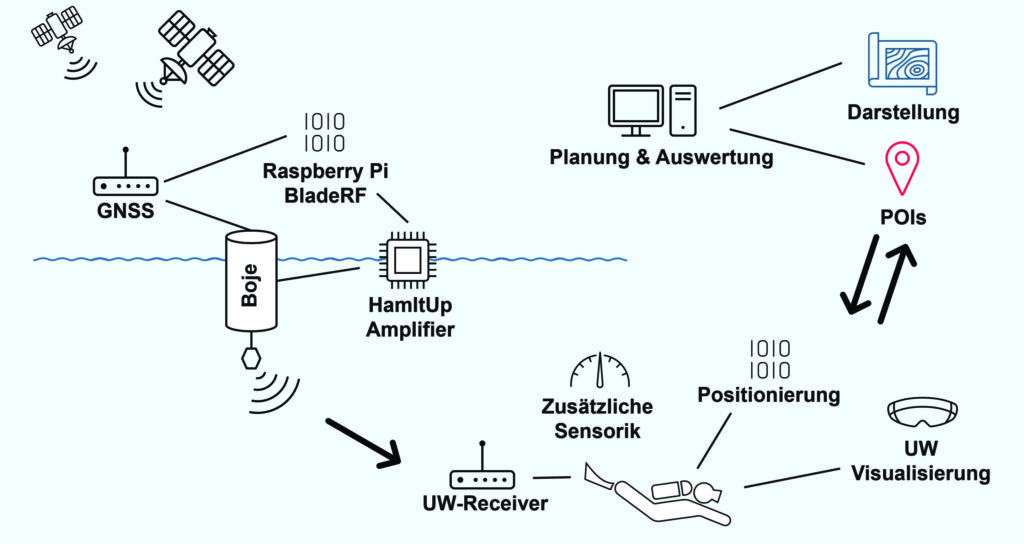
A team led by Philipp Berglez from the Institute of Geodesy at Graz University of Technology, Styria, Austria, has developed a navigation system for divers that uses GNSS-supported buoys. The buoys emit electromagnetic signals to enable animal-friendly, precise positioning underwater.
Using a heads-up display in their mask, divers can find their way to their desired destinations, back to the dive boat, or around restricted areas. The divers also can always be found in an emergency.
Wave propagation the biggest challenge
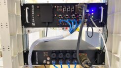
The navigation system’s operating principle combines the precision of satellite navigation with the transmission of electromagnetic signals underwater. The buoys are placed in the operational area and determine their position via GNSS, more specifically via the Galileo High Accuracy Service (HAS).
A signal generator in the buoys sends electromagnetic signals to the divers, who carry a receiver the size of a cookie. Since several buoys communicate simultaneously with the divers’ receivers, the various distance information can be used to determine their position and depth using trilateration.
Ocean environment. “The biggest challenge for us was calculating the propagation of the electromagnetic signals underwater to obtain the appropriate distance values,” Berglez said. “The properties of the water — such as salinity, temperature, depth or conductivity — have a major influence here. Due to these diverse and variable influencing factors, modeling the propagation properties underwater was particularly challenging.”
The research team succeeded in transmitting signals horizontally over 150 meters, but the scientists still see considerable potential for optimization when it comes to penetrating greater depths of up to 100 meters.
Applications. The underwater navigation system is useful for divers in several applications. In the tourism sector, it is ideal for sport and recreational diving, where dive sites equipped with position buoys help visitors find underwater sights. They can see the route there on the mask’s head-up display. The company Oxygen Scientific has already developed a head-up display mounted on the mask.
The system is also useful in the fields of aquatic ecology, underwater archaeology and underwater debris documentation.
Wildlife Friendly. It was important to the project team that the system, unlike sonar, would not impact wildlife. Test measurements were conducted with golden rainbow trout, which are normally very sensitive to external influences.
During measurements with different transmission power levels, the fish showed no abnormal behavior, and they continued to behave normally even after the measurements were completed. The golden trout were equally unaffected one week, one month and four months after the measurements, ruling out any delayed negative effects with a very high degree of probability.
In addition to TU Graz, project partners included pentamap GmbH, 1st-Relief GmbH, Oxygen Scientific GmbH, Disaster Competence Network Austria , and the Austrian Center for Research Diving.


About the Author: Tracy Cozzens
Senior Editor Tracy Cozzens joined GPS World magazine in 2006. She also is editor of GPS World’s newsletters and the sister website Geospatial Solutions. She has worked in government, for non-profits, and in corporate communications, editing a variety of publications for audiences ranging from federal government contractors to teachers.


Subscribe to GPS World
If you enjoyed this article, subscribe to GPS World to receive more articles just like it.


Follow Us