Listen to this content
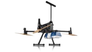
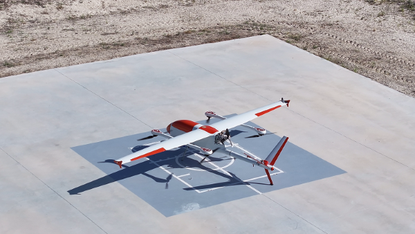
The GöKHUN unmanned aerial system (UAS) from Turkish company ESEN is a tactical vertical take-off and landing (VTOL) drone system that does not require a runway, offering maximum flexibility in operational use.
Developed for versatile missions on land or at sea, GöKHUN combines the compact mobility of a NATO Class I UAV with the performance data of a Class II tactical system. The GöKHUN UAS uses the modern SP 210 FI GS 2-stroke engine from Sky Power International.
With a take-off weight of up to 110 kg and a maximum fuel and payload capacity of 26 kg, the GöKHUN can remain in the air for up to 16 hours with a minimum payload. Even with a demanding sensor load of 12 kg, it can achieve a flight duration of around nine hours, making it suitable for long-endurance reconnaissance and surveillance missions.
The GöKHUN’s cruising speed is between 96 and 158 km/h. The maximum range with direct line-of-sight is over 150 km, with the system reaching a service ceiling of approximately 5,500 m.
GöKHUN can take off and land in an area measuring 10 x 10 meters, regardless of topographical conditions and without any infrastructure. This also allows it to be deployed in remote or difficult-to-access regions and on ships.
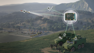
The GöKHUN was designed for complex intelligence, surveillance and reconnaissance (ISR) missions. In addition, the system is suitable for a wide range of other applications such as environmental monitoring, disaster relief, border surveillance, anti-smuggling operations and precision agriculture. With its integrated vision-based navigation system GöRDES, the drone is independent of GNSS signals and can be reliably controlled even in GPS-denied environments.
All safety-relevant systems such as navigation, flight control, data transmission and power supply are designed with double or triple redundancy. If the connection to the ground station is lost, the UAV returns autonomously to its starting point. In addition, GNSS interference protection ensures robust operation even under electronic interference.
The GöKHUN is also designed for mobility and speed. Two technicians can have the system up and run in around 15 minutes, and it can be transported in two standard vehicles. Thanks to its modular design, the system is easy to maintain and can also be easily adapted to different deployment scenarios. A particularly outstanding feature is its ability to operate two different payloads simultaneously, for example EO/IR sensors for day and night operation or different communication and reconnaissance systems. It is controlled via an integrated ground station with a data terminal, which can also be transferred to other carrier vehicles during an operation.
The system’s high environmental resistance, with an operating temperature range of −30°C to +55°C, and its ability to fly stably at wind speeds of up to 40 knots underlines its robustness. With its ITAR-free design, GöKHUN meets international export requirements and complies with NATO standards AEP-83/84. The system can be easily integrated into existing tactical networks, making it attractive to international partners.
Overall, GöKHUN combines tactical range, modular architecture, simple logistics and operational independence. With its high endurance, vertical take-off capability and safe mission execution in complex environments, the system is ideal for modern applications in security-critical but also in civil areas, whether for border surveillance, disaster relief or as an ISR platform at sea. Its independence from GNSS signals and flexible payload configuration make the GöKHUN UAS a state-of-the-art solution in the field of unmanned aerial reconnaissance.