Listen to this content
Advanced Navigation has released a product for navigating underground mines, based on its technology demonstration in October 2025.
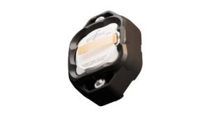
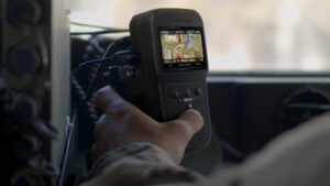
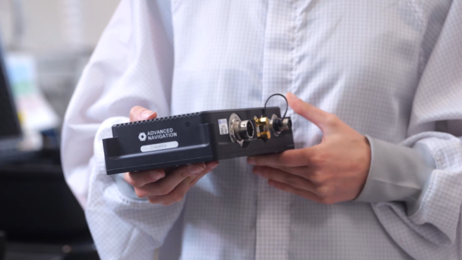
Chimera Land is a 3D laser velocity sensor (LVS) designed to solve the primary challenge for underground mining: maintaining precise vehicle positioning in deep, dark, and unmapped environments where GPS cannot reach.
When fused with an Advanced Navigation inertial navigation system (INS), Chimera Land allows underground vehicles to maintain stable navigation over extended distances and time. Instead of needing to “ask” an external beacon or satellite for its location, the sensor uses specialized lasers to measure a vehicle’s ground-relative 3D velocity with high accuracy. By feeding this precise data into the vehicle’s INS, the sensor eliminates the drift that typically comes with standalone INS.
This integration uses AdNav Intelligence, the company’s proprietary software. Drawing on adaptive algorithms, the fusion engine dynamically weights the input from each sensor, adjusting reliance in real time based on their reliability scores, environmental conditions, and operational context.
The result is a resilient, high-performance, infrastructure-light positioning solution that excels in the high-dust, zero-light conditions typical of underground mines.
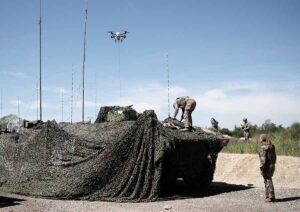
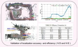
Chimera Land was demonstrated in Europe’s deepest underground mine as part of BHP’s Deep Mining Call. When integrated with Advanced Navigation’s high-performance Boreas D90 INS, the solution achieved a position accuracy of 99.9% of distance traveled. Crucially, this performance was maintained without relying on any fixed positioning infrastructure, pre-existing maps, or external aiding.
Key performance benchmarks:
- Precision at depth. The system delivered a final position error of 15.9m over a 22.9km transit (approx. 52 ft over 14 miles) at 1.4km underground.
- INS drift reduction. Chimera Land actively reduced the drift rate to a mere 0.07% per distance traveled.
- Repeatable accuracy. Validated across five separate runs, the system consistently hit an accuracy of better than 0.1%.
- Infrastructure-light. Enables full vehicle autonomy even where fixed networks and infrastructure end.
As mines move deeper and into more hostile geological frontiers, the cost of installing fixed infrastructure becomes prohibitive. Chimera Land is engineered to maintain high-confidence estimation in total darkness, heavy dust, and high-vibration mining environments.
It allows for “infrastructure-lite” operations across the value chain.
- Autonomous haulage systems (AHS). Enables continuous high-speed tramming in development areas without the need for pre-surveyed beacons.
- High-Precision machine guidance. Provides the sub-decimeter velocity accuracy required for automated drill rig alignment and robotic scaling.
- Dynamic Fleet Management. Real-time, sovereign localization allows for precise asset tracking and ore reconciliation, even in the deepest “dead zones.
- Predictive collision avoidance. High-fidelity 3D velocity data improves the “time-to-collision” calculations for safety systems, reducing nuisance alarms.