Listen to this content
Researchers demonstrate a seaplane-type UAV using GNSS-A can precisely measure seafloor deformation
Megathrust earthquakes are large earthquakes that occur on faults found along the boundaries between tectonic plates. The Nankai Trough is a megathrust earthquake zone lying off the southwestern coast of Japan, and experts estimate that this zone could generate a potentially devastating (magnitude 8 or 9) large earthquake sometime in the next 30 years. A seismic event of this magnitude could trigger cascading hazards such as destructive tsunamis.
Developing the technologies for efficient and reliable seafloor monitoring is paramount when considering the potential for socioeconomic harm represented by megathrust earthquakes. Traditionally, seafloor measurements have been obtained using transponder stations on the seafloor that communicate with satellites via buoys or ocean-going vessels to produce accurate positional information. However, data collection using such systems has problems such as low efficiency and speed.
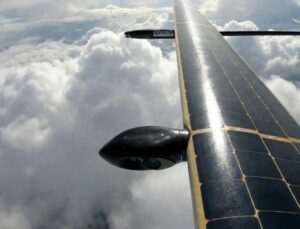
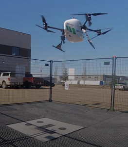
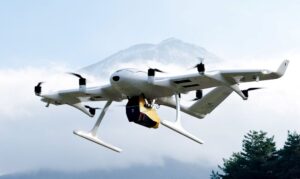
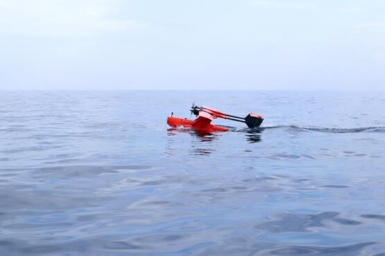
In a study published in Earth and Space Science, researchers at Institute of Industrial Science, the University of Tokyo, addressed the challenge of acquiring reliable, high-precision, real-time seafloor measurements by constructing a seaplane-type unmanned aerial vehicle (UAV) that can withstand ocean currents and wind. This vehicle is intended for use with the GNSS–Acoustic (GNSS-A) ― a system that uses satellites to determine locations on Earth ― to provide a communication link with seafloor transponder stations.
“We conducted initial experiments in a water tank,” explains lead author of the study Yuto Yoshizumi, “and found that the proposed system can detect distances to an accuracy within 2.1 cm.”
To further evaluate the system, at-sea trial tests were performed by landing the UAV on the sea surface off the coast of Japan under optimal sea conditions. “The results were hugely encouraging,” said senior author Yusuke Yokota. “These seafloor positioning measurements are the first ever achieved using a UAV, and we attained a horizontal root mean square error of approximately 1–2 cm, which is easily comparable to that of existing vessel-based systems.”
The rapid real-time acquisition of seafloor information using the UAV system developed by the research team at Institute of Industrial Science, the University of Tokyo, is expected to provide the foundation for advanced research into earthquake disaster prevention. Such data are urgently needed given the speed and frequency of occurrence of megathrust earthquakes on the Nankai Trough.
Full paper, DOI: 10.1029/2025EA004237.