No audio available for this content.
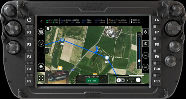
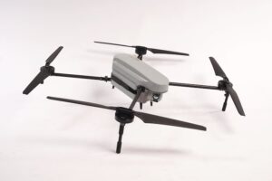
AgEagle Aerial Systems has released its eBee VISION application software, introducing a suite of updates designed to enhance drone navigation in environments where GNSS signals are compromised or unavailable.
The latest software enables autonomous position updates with map referencing, allowing for precise navigation even when satellite signals are jammed, spoofed or blocked, according to the company. This seeks to provide operational continuity for defense personnel, public safety agencies and industrial teams operating in high-stakes, GNSS-denied environments such as dense urban centers, near critical infrastructure or in contested zones with active signal interference.
The update also introduces features such as optical flow stabilization for target lock, which uses visual cues to keep the camera centered on a point of interest during zoom-ins or drone movement. The software allows for adaptive behavior after GNSS recovery or visual repositioning, enabling seamless transitions if the drone’s position suddenly updates due to GNSS recovery or visual geo-referencing.
Additional enhancements include real-time mission duration and return-to-home estimates, optimized cruise speed in windy conditions, high-precision landings using lidar-based altitude calibration, a gimbal auto-recovery mechanism to clear obstructions mid-flight and smart motor speed reduction to prevent overheating during extreme conditions.
AgEagle, founded in 2010, designs and delivers flight hardware, sensors and software for users in energy, construction, agriculture and government sectors worldwide.
