Listen to this content
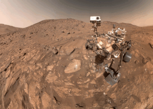
During the geomagnetic storm that took place May 10–11, 2024, GPS users reported significant positioning errors and outages. In particular, farmers in the Central United States reported difficulty in getting a fix with their tractors and other farm equipment.
Also affected, to a lesser extent, was the Southwestern United States.
The event, widely reported in the media and by GPS World, resulted in an estimated $500M loss to the farming community.
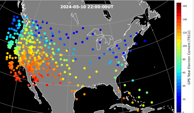
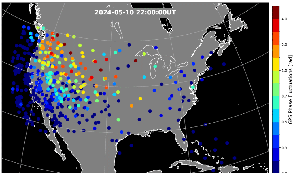
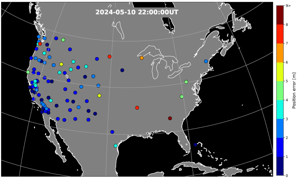
A new study has identified the cause of the GPS outages by analyzing the data from a 1‐Hz GPS receiver network. Standalone GPS position errors In precise point positioning (PPP) mode in the Central United States reached 70 meters on May 10. The errors were attributed to a steep wall in ionospheric plasma that rapidly moved southward.
In the soutwestern states, the GPS position errors were elevated 10 to 20 meters because of the enhanced plasma density.
Then, on May 11, intense auroral activity caused rapid enhancements in the ionospheric plasma, leading to abrupt position errors of 10 meters. Network‐based position systems likely encountered even longer duration of position errors because these ionospheric disturbances are localized.
“These findings highlight the need for more accurate understanding of ionospheric plasma conditions, as well as software and hardware improvements, to reduce disruptions during space weather events,” report the authors of “Spatio‐Temporal Evolution of Mid‐Latitude GPS Scintillation and Position Errors During the May 2024 Solar Storm.” Authors are Waqar Younas, Yukitoshi Nishimura , Weixuan Liao , Josh L. Semeter, Sebastijan Mrak, Jade Morton and Keith M. Groves. The full report will appear in an upcoming issue of the Journal of Geophysical Research: Space Physics and is now available on ResearchGate.
Key Points
- PPP failed to converge in the SED and trough, while PPK became unstable after CME arrival until the recovery phase.
- SED, EIA, and trough created position errors on the noon‐evening sector. Substorms caused position errors on the nightside.
- Scintillation, cycle slips, satellite geometry and ray bending were identified as contributing factors to the large position errors.
The study investigates impacts of the May 2024 superstorm on the mid‐latitude GPS scintillation and position errors. Using 1‐Hz GPS receiver data, the research team identified position errors in PPP mode reaching up to 70 m in the Central United States during the storm main phase on May 10.
The PPK solution becomes unstable following the arrival of storm and lasted till the recovery phase, coinciding with reported GPS outages of farming equipment. The large position errors were attributed to strong scintillation and carrier phase cycle slips around the equator-ward boundary of the ionosphere trough, where large total electron content (TEC) gradients and irregularities were present.
In the Southwestern United States, position errors of 10–20 m were associated with the storm‐enhanced density and equatorial ionization anomaly. Scintillation and cycle slips in this region were minor, and bending of the GPS signal paths (refractive effect) is the probable cause of the position errors. PPP outages were also associated with sudden changes in the geometric distributions of available GPS satellites used in position calculations.
On May 11, energetic particle precipitation during substorms led to abrupt jumps in TEC and scintillation, resulting in rapidly evolving position errors of up to 10 m. These findings highlight the critical role of storm‐time plasma transport, precipitation and irregularity formation in degrading GPS performance.
“The study underscores the need for accurate ionospheric state specification, improved signal processing technique, real‐time ionospheric corrections, and optimized satellite selection algorithms to enhance navigation resilience during severe space weather events,” the authors conclude.