
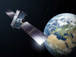
GPS, inertial technology support defense missions
April 30, 2020
2 SOPS never stops There’s no question that GPS is an essential service. The Second Space Operations Squadron […]
Read More
2 SOPS never stops There’s no question that GPS is an essential service. The Second Space Operations Squadron […]

The Association for Unmanned Vehicle Systems International (AUVSI) will host Xponential Virtual Sessions, a week-long webinar series, May […]
News from the European Space Agency As European governments plan their phased recoveries from the lockdown states triggered […]

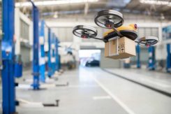
Drone maker Parrot is supporting French medical professionals facing the COVID-19 pandemic by helping Makers for Life design […]
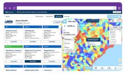
One industry important to the world’s fight and recovery from the COVID-19 pandemic is geospatial analytics. In response, […]
The North Carolina Department of Transportation (NCDOT) is working with public and private partners to launch three projects […]
New hyperlocal business directory ZoomBusiness designed to help Main Street businesses across North America engage with local residents […]

New hyperlocal business directory ZoomBusiness designed to help Main Street businesses across North America engage with local residents […]


Follow Us