From grading to mapping: Surveyors tie dirt to data
January 13, 2025
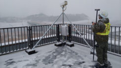
GNSS machine control is widely used on excavators, graders and dozers. It allows precise earthmoving and grading with minimal manual input from operators.
Read More
GNSS machine control is widely used on excavators, graders and dozers. It allows precise earthmoving and grading with minimal manual input from operators.

L3Harris has received a contract from the U.S. Space Force’s Space Systems Command to develop design concepts for Phase 0 of the Resilient Global Positioning System program.
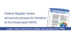
The modernization of the NSRS is scheduled for 2025. NGS intends to release associated tools and services within five years of the modernization.

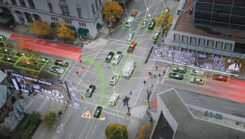
ESA will host the first FutureNAV Industry Day on Feb. 18, 2025 to address the growing demand for advanced PNT technologies.
“Seen & Heard” is a monthly feature of GPS World magazine, traveling the world to capture interesting and […]
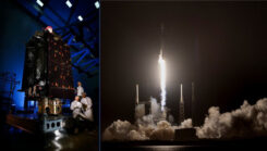
The U.S. Space Force’s Space Systems Command and Space Operations Command expedited the Rapid Response Trailblazer launch schedule.

An example of how UUVs are being used by European Navies to neutralize mines, Ukrainian defenses steering attacking drones, and drone incursions over joint UK/US nuclear bases in England.

Unidentified UAVs over military installations have sparked security concerns across the United States.


Follow Us