GLONASS CDMA signals now on L1, L2
April 29, 2024
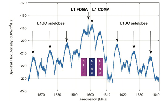
GLONASS satellites traditionally use L1 and L2 frequency division multiple access (FDMA) signals. FDMA is characterized by a […]
Read More
GLONASS satellites traditionally use L1 and L2 frequency division multiple access (FDMA) signals. FDMA is characterized by a […]

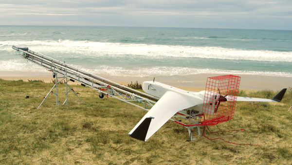
The Icelandic Road and Coastal Administration (IRCA) has commissioned the Dutch UAV manufacturer Acecore to map the extent and aftermath of the Eldvörp-Svartsengi volcanic system eruption using its high-end UAV solutions.
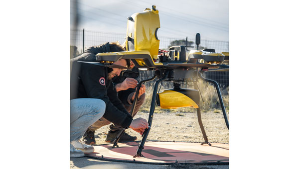
GPS World EIC, Matteo Luccio, discusses the Boreal UAV in an exclusive interview with Michael Gavart, CTO of M3 Systems.
An exclusive interview with Brandon Malatest, co-founder and COO of Per Vices What is your title and role? […]

Bridges are essential components of our transportation infrastructure, facilitating seamless travel and connecting communities. The construction and maintenance […]

For outdoor robotic applications, GNSS technology’s levels of accuracy range from sub-meter positioning to decimeter and centimeter levels in real time, depending on the specific application.

Several technologies — ranging from very mature to nascent — are converging to make autonomous vehicles and devices more useful, efficient, and reliable than ever.
In one way or another, GNSS is constantly in the news, even though it rarely makes the headlines. Three recent articles prove this point.


Follow Us