Diving into UAV lidar surveys
March 29, 2021
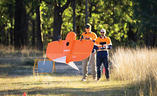
The worlds of UAVs, lidar and surveying overlap, with UAV-based lidar able to shed light on places that […]
Read More
The worlds of UAVs, lidar and surveying overlap, with UAV-based lidar able to shed light on places that […]

DJI now offers dual UAV controllers. Dual operator mode allows a pilot to focus solely on safe operation […]
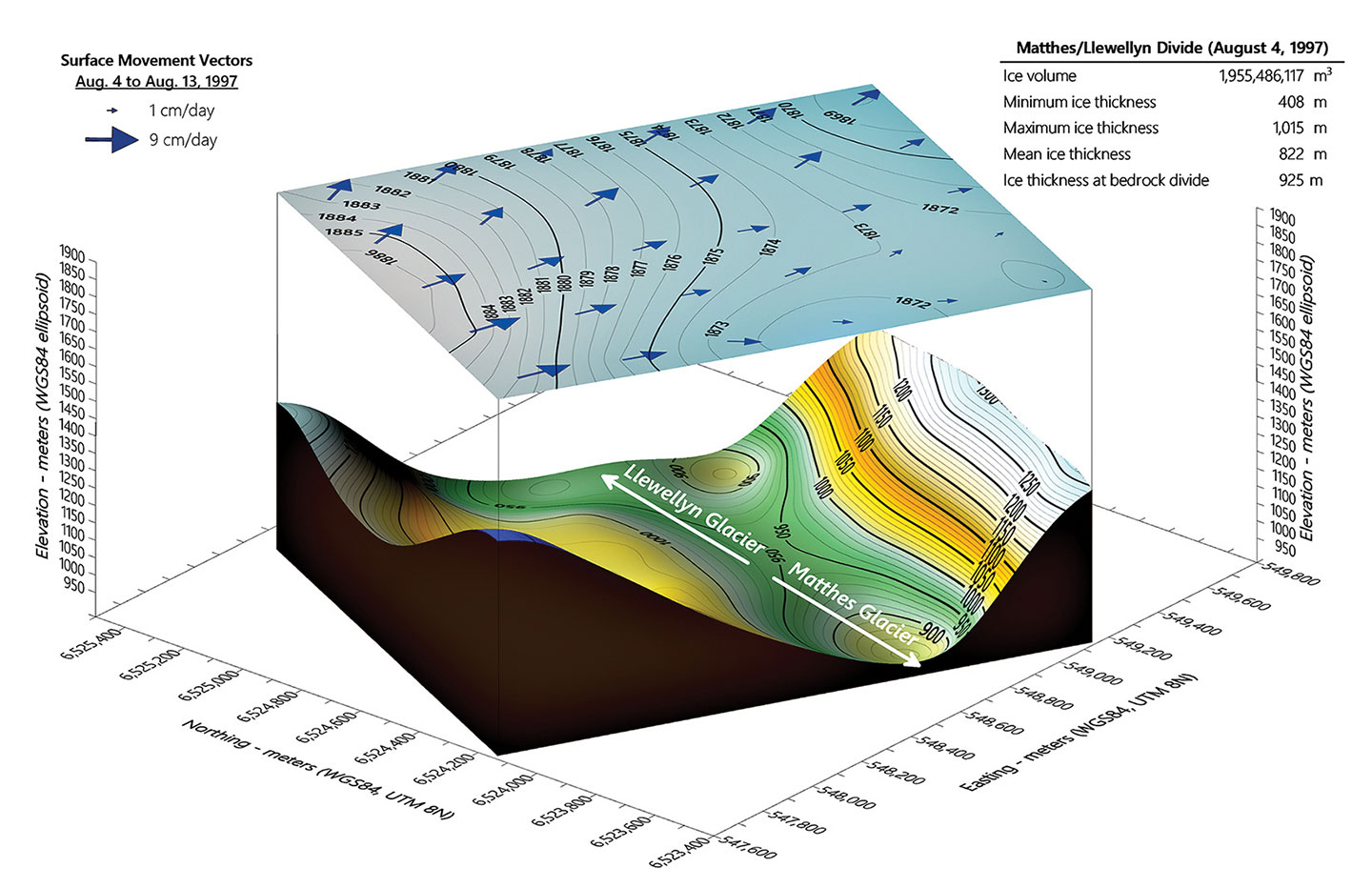
The Juneau Icefield Research Program (JIRP) calculates that thinning of Alaska’s Taku Glacier has increased from an average […]
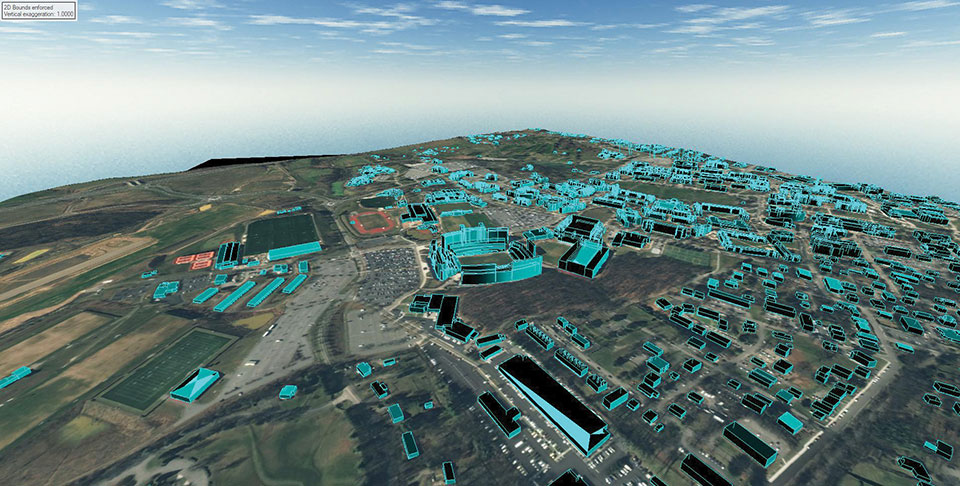
L3Harris provided a detailed digital map of Blacksburg, Virginia, to aid in the development of a Navigation Performance […]
It has been 78 years since 110,000 Japanese-Americans were forcibly interned in 10 camps across the United States. […]
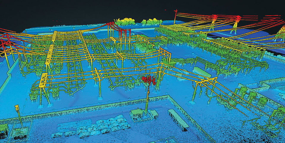
Lidar and photogrammetry payload maker Rock Robotic has finished development of its new Rock R2A payload. Featuring the […]
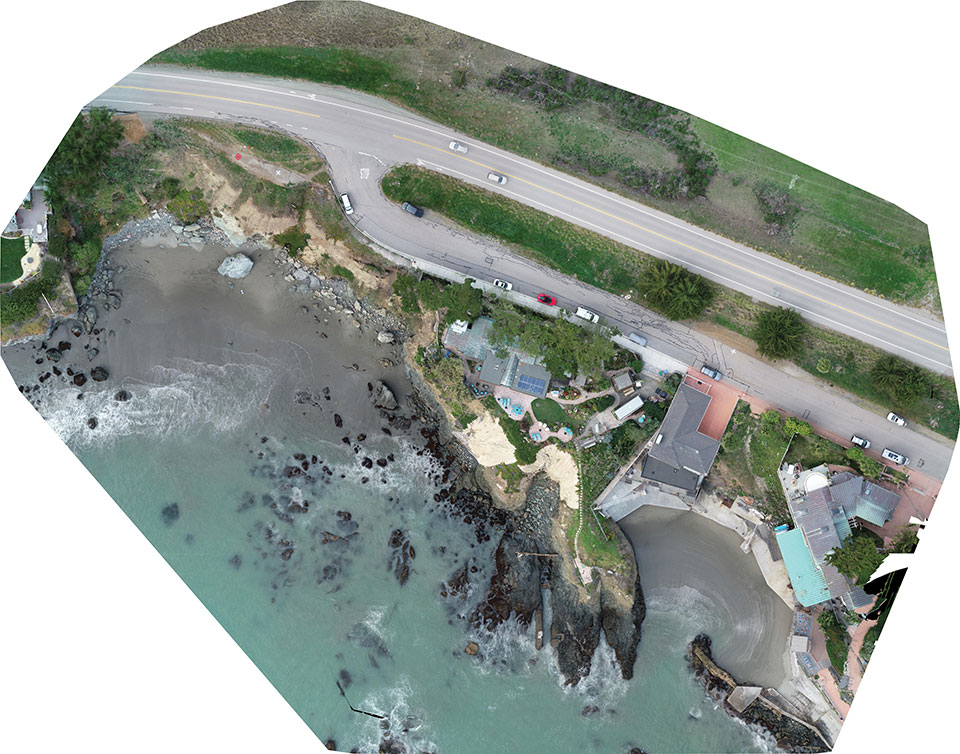
Cliff surveys are traditionally performed with fixed-wing aircraft that collect nadir photos. However, a photogrammetry company accurately triangulated […]
In September 2019, the Xinjiang Institute of Ecology and Geography conducted a nine-day project on the Heishan Mining […]


Follow Us