Trimble releases laser scanning system
June 8, 2023
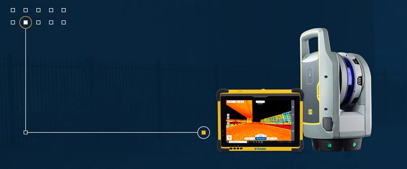
Trimble has released the X9 3D laser scanning system — a versatile reality capture solution suitable for surveying, construction and engineering users.
Read More
Trimble has released the X9 3D laser scanning system — a versatile reality capture solution suitable for surveying, construction and engineering users.
Aerial mapping provides a competitive advantage for AEC companies to win their fair share of the $17 billion infrastructure bill.
Deal makes data from 40 Chinese satellites available through UP42 now, another 40 by late 2021 UP42 has […]

$50K prize purse for solutions to advance computer vision for time-sensitive mapping The National Geospatial-Intelligence Agency (NGA), Johns […]
Skyward, a Verizon company, has announced its integration with Pix4D, a photogrammetry software suite for drone mapping. The partnership gives […]
Drone company Parrot is partnering with Rapid Imaging, a technology provider delivering geospatial augmented reality (AR) and situational awareness solutions […]
In recent years, sinkholes have been occurring around the world. A new service offers a sinkhole detection prediction […]


Follow Us