Skip to content

Latest News

Photo: skiserge1 / iStock / Getty Images Plus / Getty Images

First fix: Trouble in orbit

June 14, 2024

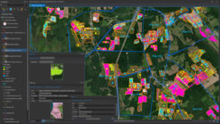
In ArcGIS Pro, administrators and agronomists view short term plans and historical information. The map views allows them to analyze passes over fields, coverage of treatments, quantities of materials, water drainage, and other variables to inform treatment decisions. (Photo: Courtesy of Ernst Seeds)

Seeds of change: Ernst Seeds uses data-driven approach to restore habitats

June 13, 2024

Photo: Jetlinerimages / E+ / Getty Images

Study: GPS disruptions in aviation show importance of backups

June 12, 2024

Photo: BAE Systems

BAE Systems unveils anti-jamming GPS receiver

June 12, 2024

This article is tagged with and posted in Defense, Latest News
Photo: LabSat

LabSat launches GNSS simulator

June 12, 2024

This article is tagged with and posted in Latest News, Simulators
Photo: Geomax

GeoMax launches GNSS smart antenna

June 11, 2024

This article is tagged with and posted in Latest News, Machine Control/Ag, Survey
Photo: NAVSYS logo

NAVSYS secures AFRL contract for complementary PNT solution

June 11, 2024

Wangjie Zhao, an employee of CHC Navigation. (Photo: CHC Navigation)

Surveying & Mapping: Overlapping technologies and professions

June 10, 2024