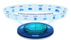
BDStar unveils chip-cloud integrated business strategy
October 10, 2025
BDStar Navigation Co. Ltd., a provider of positioning technology solutions, has announced its chip-coud integration strategy and introduced […]
Read More
BDStar Navigation Co. Ltd., a provider of positioning technology solutions, has announced its chip-coud integration strategy and introduced […]

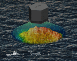
Drone-maker Orkid has unveiled a new variant of its Orkid 260 drone that incorporates four technologies to improve aerial data-capture technology.
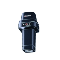
GEODNET, provider of a decentralized real-time kinematic (RTK) network, has launched GEO-MEASURE, a survey-grade GNSS rover that delivers […]

According to global technology intelligence firm ABI Research, global GNSS chipset shipments are projected to grow to 2.4 billion by 2029.
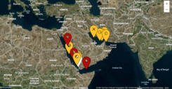
The UK Maritime Trade Operations (UKMTO) has issued an advisory following a surge in reports of interference affecting GNSS and Automatic Identification System (AIS) displays.
A software-ruggedized quantum navigation system was chosen as one of The Best Inventions of 2025 by TIME magazine.
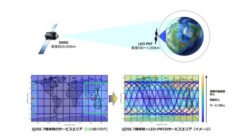
Japan Aerospace Exploration Agency (JAXA) has selected ArcEdge Space to develop a satellite positioning system designed to complement existing GNSS.

Quectel Wireless Solutions has introduced the Quectel LR700A smart connected GNSS receiver, an all-in-one high performance quad band base station solution.


Follow Us