From grading to mapping: Surveyors tie dirt to data
January 13, 2025
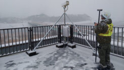
GNSS machine control is widely used on excavators, graders and dozers. It allows precise earthmoving and grading with minimal manual input from operators.
Read More
GNSS machine control is widely used on excavators, graders and dozers. It allows precise earthmoving and grading with minimal manual input from operators.
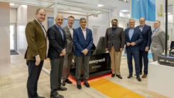
Honeywell and NXP Semiconductors have expanded their partnership to advance aviation technology and autonomous flight capabilities.

Bad Elf and GEODNET have introduced a five-year RTK service for Bad Elf GPS receivers, designed to provide high-accuracy GPS positioning.

L3Harris has received a contract from the U.S. Space Force’s Space Systems Command to develop design concepts for Phase 0 of the Resilient Global Positioning System program.

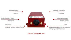
Hexagon has entered an agreement to acquire Septentrio, a move aimed at advancing resilient assured positioning solutions across various industries.

Swift Navigation and Quectel Wireless Solutions have partnered to enhance GNSS accuracy across various industries.
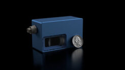
Voyant Photonics has introduced the Carbon frequency modulated continuous wave (FMCW) lidar sensor.


Follow Us