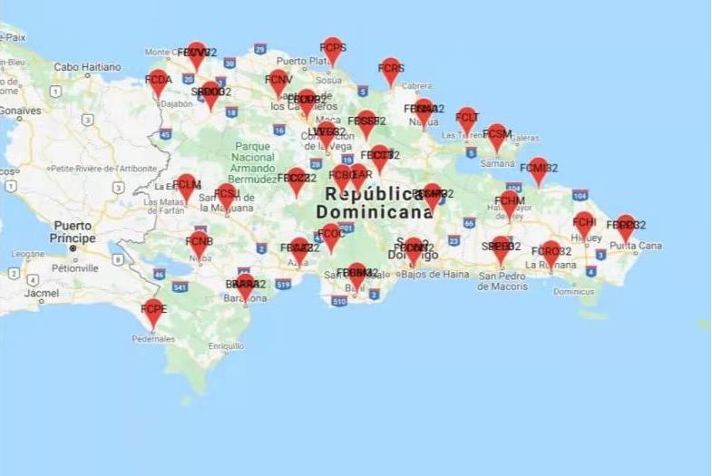
China launches remote sensing satellite
April 13, 2023
China launched the Yaogan-34 04 remote sensing satellite from the Jiuquan Satellite Launch Center in northwest China on March 31.
Read More
China launched the Yaogan-34 04 remote sensing satellite from the Jiuquan Satellite Launch Center in northwest China on March 31.
uAvionix has introduced truSky ADS-B spoofing detection for its SkyLine Uncrewed Aircraft System (UAS) beyond visual line of sight (BVLOS) services.
One way to implement direct georeferencing on UAV platforms is the Trimble APX-20 UAV, a GNSS-inertial OEM solution that increases the mapping efficiency of small UAVs.
Bluesky International and SkyFi have collaborated to provide access to Earth observation assets and multi-perspective imagery to users globally.
NV5 Geospatial has mapped more than 26 million acres of North America’s shoreline and riverine environments across more than 200 projects.
A joint development program by the DHS and NASA’s Jet Propulsion Laboratory has produced a unique indoor positioning and location solution, POINTER.
Sharper Shape has used SimActive software’s distributed processing capabilities to complete utility corridor base maps in Montreal, Canada.
The catastrophic earthquake that struck Turkiye and northern Syria on Feb. 6, killing more than 50,000 people, has highlighted the need for improved methods to monitor surface changes.
Follow Us