December 28, 2022 CHC Navigation: UAS use on the rise for corridor mapping By Matteo Luccio and Gavin Schrock
December 28, 2022 Trimble: European company reduces emissions and improves deliveries By Matteo Luccio and Gavin Schrock
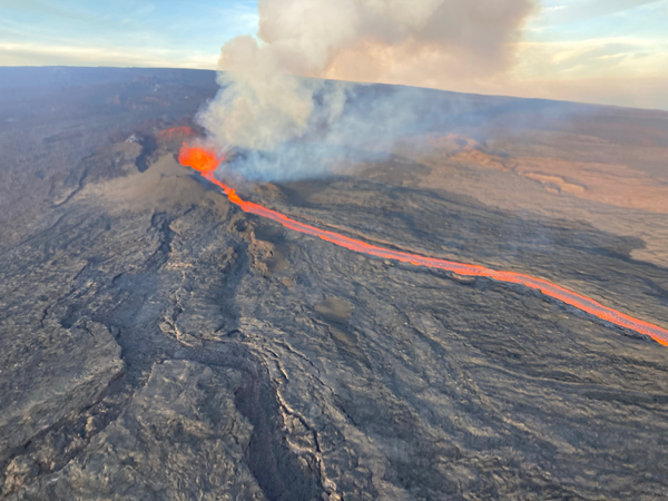
December 9, 2022 Satellite observation is helping to map lava from Hawaii’s Mauna Loa volcano By Maddie Saines
December 8, 2022 Spirent offers SimORBIT to help developers determine LEO for lab tests By Maddie Saines