July 8, 2025 CHCNAV’s cloud-based platform enhances 3D data processing and collaboration By Jesse Khalil
July 7, 2025 Seen & Heard: Mapping electronic warfare, Türkiye’s satellite system and quantum GPS backup By Jesse Khalil
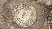
July 2, 2025 Inside the new NSRS beta tools and a journey through geodetic history By David B. Zilkoski
June 19, 2025 ComNav launches laser scanner designed for challenging GNSS environments By Jesse Khalil
June 16, 2025 Crafting a GNSS curriculum for the future geospatial workforce By Laura C. Loyola, Guoping Huang, Isaiah Mack, and Yi Qi