
Launchpad: Autonomous vehicle software, GNSS avionics, more
February 13, 2019
A roundup of recent products in the GNSS and inertial positioning industry from the February 2019 issue of […]
Read More
A roundup of recent products in the GNSS and inertial positioning industry from the February 2019 issue of […]
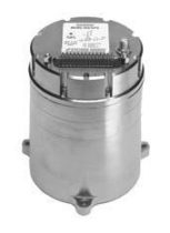
Systron Donner Inertial (SDI) has released an update to its SDN500 digital quartz MEMS GPS inertial navigation system […]
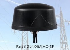
PCTEL Inc. released at DistribuTECH a new dual-band 802.11ac/p MIMO antenna that helps boost data rates and reliability […]

Global GNSS, a subsidiary of Polosoft Technologies, has launched a new mobile application named GNSS Surveyor, which is […]

WTS Positioning Solutions, a Swedish GPS tracking company, has released its next generation of smart GPS trackers: the […]

Virtual Surveyor drone surveying and mapping software has added new functionality that enables users to process larger projects […]
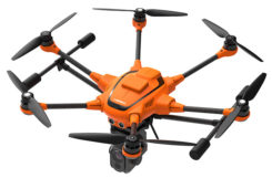
Yuneec International’s commercial hexacopter, the H520, will now optionally be available with an RTK (real-time kinematic) system from the […]
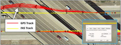
Dime-sized INS with RTK paves the way for high accuracy in mass-market consumer applications. Inertial Sense has released […]


Follow Us