Greenland is twisting and stretching, GNSS data shows
October 17, 2025
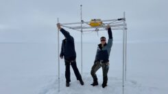
Greenland is being twisted, compressed and stretched, according to researchers in the Department of Space Research and Space […]
Read More
Greenland is being twisted, compressed and stretched, according to researchers in the Department of Space Research and Space […]

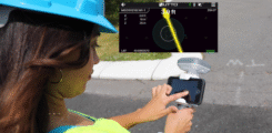
Emlid has introduced a new generation of all-band RTK receivers including the Reach RX2, Reach RS4 and Reach RS4 […]
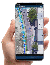
ProStar’s PointMan software will now be bundled with Bad Elf’s high-precision GNSS receivers for worldwide sales.
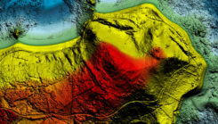
NV5 has become the first geospatial company to acquire and deploy Hexagon’s Leica CoastalMapper.
The partnership enables UTTO to leverage GEODNET’s global RTK correction services across its solutions.

Drone-maker Orkid has unveiled a new variant of its Orkid 260 drone that incorporates four technologies to improve aerial data-capture technology.
GEODNET, provider of a decentralized real-time kinematic (RTK) network, has launched GEO-MEASURE, a survey-grade GNSS rover that delivers […]

Quectel Wireless Solutions has introduced the Quectel LR700A smart connected GNSS receiver, an all-in-one high performance quad band base station solution.


Follow Us