Search pattern planning for UAVs helps rescue response
August 9, 2018
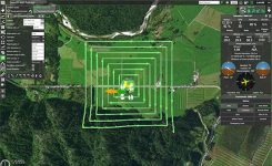
UgCS, a provider of mission planning software for unmanned aircraft systems (UAS), and public safety and disaster response […]
Read More
UgCS, a provider of mission planning software for unmanned aircraft systems (UAS), and public safety and disaster response […]
A GPS-like ground-based technology teamed with inertial measurement and driving robots to deliver the necessary accuracy when obstructions knocked out GPS as a reliable sole sensor.
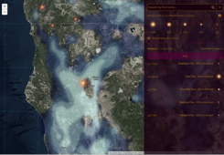
An Esri Storymap provides a quick snapshot of the raging fires across the United States and provides context […]

Komatsu America Corp. and Propeller Aero Inc. are partnering to boost the efficiency of construction job sites using […]

Authenticated localization in driverless cars Growing awareness of the vulnerabilities of GNSS signals — weak, unencrypted and easily […]
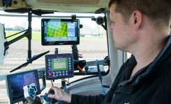
Precision agriculture depends on the precise positioning of augmented GNSS. In Europe, this augmentation is provided by the […]
NXP Semiconductors N.V. has announced the next phase in its Smart City collaboration with Columbus, Ohio, the winner of […]

China has launched another pair of BeiDou-3 navigation satellites, reports Xinhua News Agency, China’s state-run press agency. A […]


Follow Us