
AI maps: The digital infrastructure driving autonomous systems
July 21, 2025
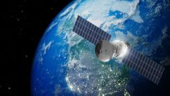
Millions of transportation decisions are now made automatically, thanks to artificial intelligence and real-time location mapping.
Read More
Millions of transportation decisions are now made automatically, thanks to artificial intelligence and real-time location mapping.

Honeywell has been selected by the U.S. Department of Defense’s (DOD) Defense Innovation Unit (DIU) to participate in the Transition of Quantum Sensing (TQS) program.

Recent advances in helicopter UAVs by Alpha Unmanned Systems and NASA’s Dragonfly mission, which plans to send a UAV to explore Saturn’s moon.

GloTEC is a real-time global Total Electron Content (TEC) map from NOAA’s Space Weather Prediction Center (SWPC). GloTEC assimilates both ground- and space-based observations to provide real-time global ionospheric corrections without relying on error-prone linear combinations.
Modern warfare is no longer about guns and bombs. Jamming, spoofing and using sophisticated cybertricks to disrupt GNSS are now regular tactics.
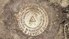
Dave Zilkoski highlight some history of the Coast and Geodetic Survey and provide the latest information on the National Geodetic Survey new National Spatial Reference System (NSRS).

Turkey is laying the groundwork for its own satellite navigation system, the Bölgesel Konumlama ve Zamanlama Sistemi (BKZS).
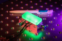
Fraunhofer IAF presented the latest version of its compact integrated quantum magnetometer at World of Quantum in Munich.


Follow Us