No audio available for this content.
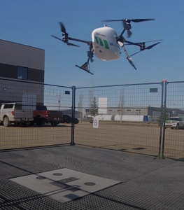
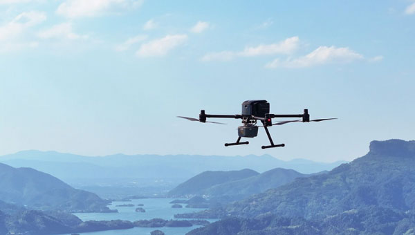
CHC Navigation (CHCNAV) has introduced the X500 rotor UAV, designed for precision aerial operations. It is ideal for surveying, urban monitoring, emergency response, disaster relief and infrastructure inspection.
Equipped with advanced navigation and safety features, the X500 rotor UAV meets the demands of professional operations. Dual GNSS and triple inertial measurement unit redundancy enhance positional accuracy and reliability, whereas integrated millimeter-wave radar provides precise obstacle detection. The drone’s video transmission system supports HD feeds over distances of up to 20 km, and its V-SLAM visual positioning ensures accuracy for tasks such as landing on moving platforms.
The X500 is designed to handle diverse payloads, with a capacity of up to 5 kg and flight durations of up to 58 minutes — or 50 minutes when equipped with the CHCNAV AA10 lidar system. Its open SDK and compatibility with the Mavlink protocol allows for seamless integration with both CHCNAV sensors and third-party equipment. Built for demanding conditions, the X500 features an IP55 rating and can operate in winds up to 12m/s.
The UAV features a new power system, enabling up to 58 minutes of flight time. According to CHCNAV, the BS10 charging station minimizes downtime by charging six batteries from 20% to 90% in just 40 minutes, while hot-swappable batteries ensure uninterrupted operations during extended missions.
Complementing the X500’s hardware is CHCNAV’s SmartGo ground control software, which simplifies mission planning and offers real-time flight monitoring. With various flight path options and beyond visual line of sight capabilities, SmartGo ensures safe, efficient operations while providing full control over mission parameters.