Listen to this content
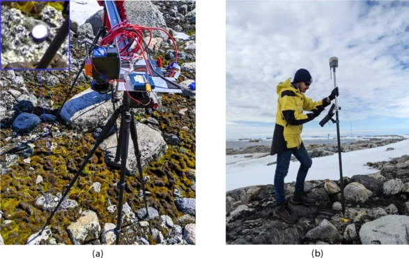
GNSS and unmanned aerial vehicles (UAVs) have revolutionized precise mapping in polar regions. For a team from Queensland University of Technology (QUT), UAVs enabled a flexible platform for deploying hyperspectral imaging (HSI) sensors and collecting high-resolution data, enhanced by GNSS with real-time kinematic (RTK) to ensure accurate geolocation for reliable vegetation analysis.
The team turned to UAVs to meet the unique challenges of monitoring Antarctic vegetation. Harsh conditions, remoteness, limited access and climate variability make traditional field surveys time-consuming and costly. Worse, they risk disturbing sensitive vegetation, explain the researchers.
What Grows There. Antarctica’s terrestrial ecosystems are home to freeze-tolerant vegetation like mosses and lichens, which play a crucial role in biogeochemical cycles, soil insulation and supporting biodiversity. These organisms underpin the continent’s fragile ecosystems, increasingly threatened by climate change, extreme events, and human activitiees.
While satellite imagery enables large-scale observations, its limited spectral and spatial resolution, alongside cloud interference, constrains fine-scale vegetation analysis. HSI captures a broad wavelength range, enabling discrimination of vegetation by their spectral signatures. Multispectral imaging (MSI) data, such as that from Sentinel-2, is also being explored.
Each technology contributes uniquely:
- GNSS RTK provides georeferencing
- Machine-learning techniques enable precise segmentation
- UAVs offer flexible spatial coverage and high-resolution datasets.
However, unless these elements are integrated, mapping accuracy diminishes. Moreover, limited validation of spectral libraries and simulated imagery against field data restricts the reliability of remote sensing outcomes.
The team’s study addresses current gaps by building on the UAV-based HSI workflow that incorporates ground-based HSI data and MSI. “We expand this approach by integrating UAV-captured HSI data to enhance remote sensing capabilities in polar environments,” researchers explain. The updated methodology combines UAVs, high-resolution red, green, blue (RGB) imagery, and ground and aerial HSI data with machine-learning-based semantic segmentation.
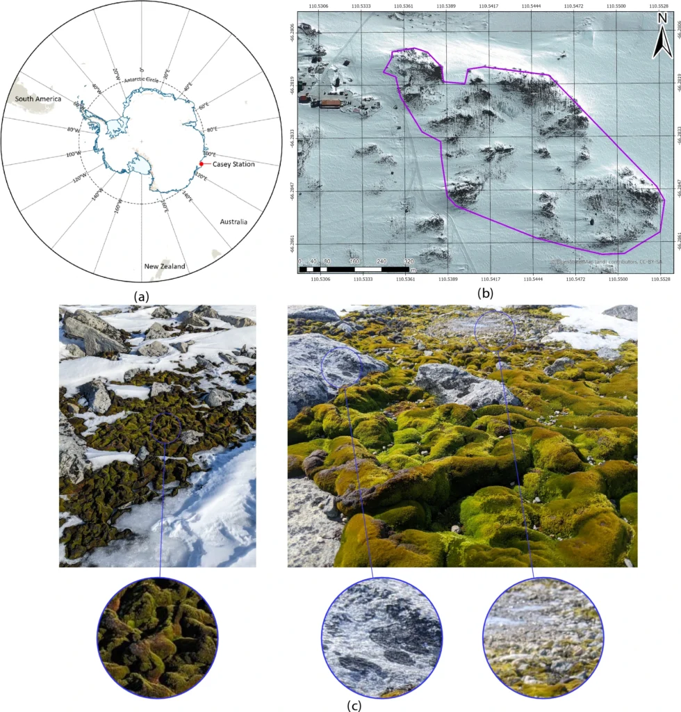
The new workflow was evaluated in Antarctic specially protected area (ASPA) 135, Windmill Islands, East Antarctica, focusing on lichen detection and moss health mapping (Fig. 1).
Read the full study, “Drone hyperspectral imaging and artificial intelligence for monitoring moss and lichen in Antarctica,” on the Scientific Reports website.