Listen to this content
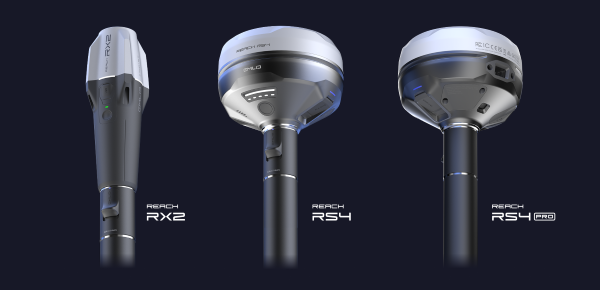
Emlid has introduced a new generation of all-band RTK receivers including the Reach RX2, Reach RS4 and Reach RS4 Pro. They are built for surveyors, GIS specialists and construction teams seeking reliable, high-accuracy positioning with consumer-level ease of use. This EU-based developer of high-precision GNSS receivers and software is on a mission to make professional-grade precision simple, fast and scalable.
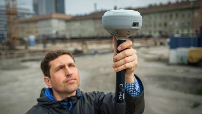
The Reach RS4 and RS4 Pro mark a significant step forward from previous Emlid models, combining rugged engineering with faster workflows and uncompromised accuracy. The flagship Reach RS4 Pro introduces innovative camera-vision technology that blends traditional RTK with visual positioning to cut survey time and simplify work in complex environments.
Both receivers support all-band RTK reception (L1/L2/L5/L6) across every major satellite constellation, ensuring consistent performance even under canopy or in urban canyons. An integrated antenna system with diversity LTE, dual-band Wi-Fi and Bluetooth provides a clean GNSS signal and stable fix, while the Emlid multi-band radio system — up to 2W and interoperable with third-party gear — offers flexible correction transmission at 450MHz and 915MHz for both licensed and licence-free use.
Further enhancements include next-generation IMU tilt compensation that initializes up to five times faster than before, a durable magnesium alloy body with IP68 protection, and Made for iPhone certification enabling smooth integration with iOS applications such as Esri ArcGIS. A new quick-release survey pole mount ensures fast and accurate setups, even when tilted.
AR-based stakeout and measurement from images. Building on the RS4 platform, the RS4 Pro adds dual factory-calibrated full-HD cameras that enable augmented reality (AR) stakeout and measurement from images. The AR interface projects geometries directly in the Emlid Flow app, guiding users intuitively to stakeout points. The image-based measurement feature allows for accurate coordinate capture from photos, which is ideal for hard-to-reach places such as facades or active roadways. Together, these vision-based tools streamline fieldwork and reduce reliance on total stations in difficult conditions.
For users prioritizing mobility, the Reach RX2 delivers professional RTK performance in a compact, plug-and-play format. Like its larger counterparts, it supports all-band RTK signals and features a second-generation IMU tilt compensation system for level-free measurements. A new quick-release mount enables rapid setup in the field.
Designed for GIS, construction and asset management teams managing multiple projects, the Reach RX2 integrates seamlessly with Esri ArcGIS for data collection and Pix4Dcatch for mobile terrestrial scanning.
Complete field-to-office workflow. Emlid’s product ecosystem — including the Emlid Flow mobile app and Emlid Flow 360 cloud platform — creates a complete field-to-office workflow for professionals who value simplicity without sacrificing precision. The system enables companies to assign surveying tasks to non-surveyor teams, reducing training requirements while maintaining professional accuracy standards.


