Listen to this content
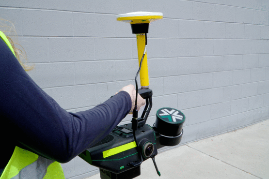
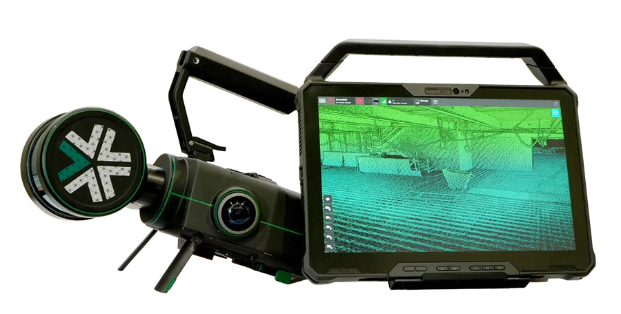
Exyn has integrated the Trimble DA2 GNSS System, an RTK-capable GNSS receiver, with the Exyn Nexys autonomous mapping platform, bringing centimeter-level geospatial accuracy to SLAM-based mobile 3D mapping.
The new capability enables users to pair Exyn Nexys’ lidar-based SLAM mapping with high-precision RTK corrections, allowing teams to georeference and anchor point clouds directly in the field without relying on ground control points or post-processing workflows. The result is faster, safer, and more accurate decision-making for industries including mining, construction and critical infrastructure inspection. Intelligently combining RTK and SLAM delivers highly accurate and robust point clouds — even in challenging environments.
When paired with the real-time colorization, users gain an added layer of visual context, enabling photorealistic mapping and the extraction of immersive georeferenced 360° imagery for enhanced situational awareness and analysis.
With the Trimble DA2 GNSS RTK integration, Exyn Nexys can now:
- deliver real-time, centimeter-accurate global positioning
- seamlessly integrate underground and surface-level scans into unified, georeferenced datasets
- accelerate project timelines by reducing dependency on traditional ground control setups
- improve accuracy and alignment for as-builting, volumetric measurements, construction progress tracking / QA, and mine planning.
This enhancement is particularly useful for hybrid environments where teams operate in both GPS-available and GPS-denied zones. The Nexys with DA-2 enabled RTK allows for seamless transitions between these areas while maintaining global coordinate consistency, so Exyn Nexys can serve as a true end-to-end solution for autonomous 3D data capture.
The Trimble DA2 GNSS and Exyn Nexys integration kit is available immediately for plug-and-play compatibility.


