No audio available for this content.
GPS World is a business-to-business magazine, and most of our readers are engineers, surveyors and other professionals specializing in geospatial technologies. In general, we do not cover consumer applications. Nevertheless, it is important to remember that, while GPS was designed and built, and is managed, by the U.S. military (from 1973 to 2020 by the U.S. Air Force, since then by the U.S. Space Force), more than 99.9% of its users are not members of the U.S. military, nor surveyors, but consumers. They benefit from GPS — and the three other GNSS, namely Russia’s GLONASS, China’s BeiDou and Europe’s Galileo — in many ways and are unaware of most of them, such as the fact that GNSS receivers provide essential timing for radio and television broadcasts, cellphone communications and financial transactions.
The vast majority of consumers access GNSS via their smartphones. We are all familiar with the myriad smartphone applications that rely on GNSS for positioning and navigation — from Google Maps and Apple Maps to Waze and social media platforms such as Instagram. Additionally, weather apps, such as the Apple Weather app, and parking apps utilize GNSS to enhance user experience and functionality. Nearly all smartphones today use at least three of the GNSS constellations — GPS, GLONASS and Galileo — and some use all four. (The use of BeiDou in the United States is a controversial topic that we will explore soon.)
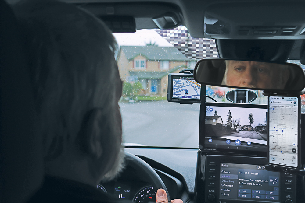
For most people, smartphones have replaced such previously separate electronic devices as calculators, digital cameras and car navigators. (A freestanding GNSS-based car navigation device is still useful, however, when you travel in areas with spotty or nonexistent cell phone coverage, because it relies on maps stored on the device, so it does not require an Internet connection. That is why I still carry a nearly 20-year-old Garmin nüvi in my car.)
For a few years, there were even handheld televisions. (My 1989 Casio TV-400 LCD Pocket Color handheld VHF-UHF TV has a 4 cm x 3 cm LCD screen. It is analog, however, so it stopped working when U.S. television broadcasts switched to digital in 2009.) Now, many people watch news, shows and movies on their phones.
Nevertheless, there are still many freestanding GNSS-based devices. For example:
- Handheld receivers for hikers and boaters that display your position and heading on topographic maps or nautical charts, as well as such information as elevation, speed, distance to your destination, number of GNSS satellites in view, tides, and sunset and sunrise times.
- Cyclometers that show bicyclists their speed, pace and position on a map.
- Fitness trackers and smartwatches that track your exercise, sleep, heart rate and biometric data.
- Tracking devices that monitor the movements of people, such as children and Alzheimer’s patients, and help recover stolen vehicles and boats.
Additionally, many digital cameras have GNSS receivers that insert the location of each photo into their metadata.
Since I began working in this industry 25 years ago, I have always detested the term “GPS tracker” because it reinforces the already widely held misperception that a GPS receiver somehow “tracks” its user. As most readers of this magazine know, GPS receivers only display and/or store location data for the user, without sharing it with anyone else, let alone broadcasting it. Tracking something requires coupling a GPS receiver with a way to transmit the location data — typically, using a cellphone connection. Plus, nowadays, the word GPS should in most cases be replaced with GNSS. Therefore, I am always careful to say or write “GNSS-based devices.”
What follows highlights three very different GNSS applications in consumer devices:
- Handheld receivers and smartwatches by Garmin for outdoor recreation and fitness.
- GNSS-based tracking of vulnerable people.
- A smartphone application from Google to monitor jamming and spoofing.
— Matteo Luccio, Editor-in-Chief
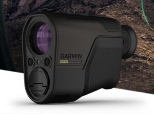
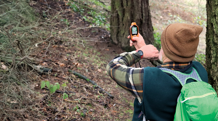
Handheld GNSS Receivers
Garmin, founded in 1989, is the 800-pound gorilla in the consumer GNSS market. The company’s annual revenue of more than $5 billion is comparable to the nearly $4 billion annual revenue of Trimble, founded in 1978, which is the 800-pound gorilla in industrial GNSS markets.
Garmin sells a vast array of handheld receivers, smartwatches and other devices for outdoor recreation and fitness, as well as GNSS receivers for general aviation and marine navigation.
In remote areas with scant or no cellphone reception, Garmin’s GNSS receivers offer users substantially more reliable satellite reception and greater positioning accuracy than smartphones. That is for two reasons. First, because a Garmin receiver can host a larger GNSS antenna than a smartphone, which contains several antennas. Second, because it is mostly dedicated to the positioning and navigation mission — unlike the many missions crammed into a smartphone.
Garmin’s multi-constellation and multi-band GNSS handheld receivers come with preloaded topographical maps optimized for outdoor activities, with terrain contours, summits, coastlines and more.
Garmin’s latest line of handheld GNSS navigators — the Montana 710i and Montana 760i — feature built-in inReach technology, which allows users to stay in touch when venturing beyond cell service using reliable satellite communication. Users can utilize two-way text messaging and location tracking via the global Iridium satellite network. In the event of an emergency, users can send an interactive SOS message to Garmin Response, an international emergency assistance coordination center that is staffed 24/7/365.
These devices are ideal for a variety of outdoor activities, including hiking, mountain biking, off-road riding and more. They are also compatible with multiple mounting options to adapt for use on ATVs, boats, cars, motorcycles, RVs and other vehicles.
Garmin Smartwatches
Garmin smartwatches have established themselves as leaders in the fitness and outdoor adventure market. Whether running, cycling, swimming or golfing, Garmin smartwatches provide users with many activity-specific features and metrics.
These watches feature advanced heart rate monitors and pulse oximeters for health monitoring. The company’s latest line of smartwatches come with a Body Battery feature that continuously analyzes combinations of the user’s heart rate, heart rate variability and movement data. The goal of this analysis is to identify meaningful physiological states and to describe the impact they have on the body’s energy levels. At a high level, this means documenting whether users are awake or asleep and when they are physically active, as well as tracking stress levels during periods of inactivity, according to Garmin.
Garmin smartwatches also feature additional sensors to improve location data. They include an altimeter sensor that helps track elevation changes and an accelerometer that detects movement. The latter is used for such tasks as step counting, sleep tracking and other activity measurements.
Garmin watches use multi-constellation (GPS, GLONASS, BeiDou and Galileo) GNSS receivers that enable accurate distance, pace and route mapping during outdoor activities, even in challenging environments.
— Jesse Khalil, Associate Editor
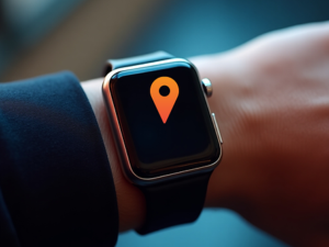
Tracking Family Members and Pets
GNSS technology enables consumers to track those most important to them – their family, friends and even their pets.
Companies such as u-blox offer devices that can be worn by the elderly and children to enable their caregivers or parents to track them. The devices help locate individuals through ›GNSS receivers (using all four GNSS constellations); Bluetooth, Wi-Fi and low power wide-area cellular communications; and cloud connectivity.
Families can monitor the movements of their children as they travel to and from school by bus by tracking those buses as they drive along their routes. Families can better time their kids’ departure to the bus stop in the morning and know when the bus has returned in the afternoon — all by viewing a live tracking function, provided by the school district, on their computer or smartphone.
Some of the newest tracking technology was on display at this year’s Consumer Electronics Show (CES) in Las Vegas in January. SATELLAI, a provider of AI-integrated pet solutions, showcased its SATELLAI Tracker and SATELLAI Collar. “The SATELLAI Tracker and the SATELLAI Collar use satellite and AI technologies to accurately relay their positions and status at all times,” said Mark Mao, founder and CEO of SATELLAI.
The lightweight tracker attaches to a padded harness that won’t snag, cause discomfort or hinder a pet’s mobility, according to the company. It features the Qualcomm MDM9205S modem, the 3GPP Rel17 5G IoT-NTN satellite communications system and the Aware platform, allowing it to use both cellular and satellite communication for continuous tracking even in remote areas without terrestrial cellular coverage. Working with the Skylo communications network ensures that the tracker works with more than 680 global networks across more than 180 countries. The SATELLAI Collar leverages a dual antenna and a multi-constellation GNSS receiver to deliver precise tracking, even in areas with low connectivity, the company adds.
Tractive, a global provider of pet GNSS and health tracking, also unveiled its latest dog tracker at CES in Las Vegas. Companies are also offering new ways to keep pets within areas chosen by their owners. According to Tractive, most virtual fences use a collar-mounted GNSS-based tracker in combination with an app or software. Users can create their preferred fence boundaries and receive notifications when pets cross them. Utilizing Mapbox’s advanced mapping platform, the SATELLAI Collar also allows users to manage these virtual boundaries, supporting overlapping and nested fences. The collar supports virtual fencing for areas up to 100,000 acres. Virtual fences are also commonly used with cattle.
— Brian Richesson, Senior Editor-in-Chief
Google Tools for Detecting Jamming & Spoofing
The sharp increase in the past few years of instances of GNSS jamming and spoofing, much discussed in these pages especially with regards to civil aviation, also affects smartphones, smartwatches and other consumer devices. Google — which makes the Pixel phones as well as Android, the most used operating system, which is used by three quarters of the world’s smartphones — has been developing a tool to help detect these attacks.
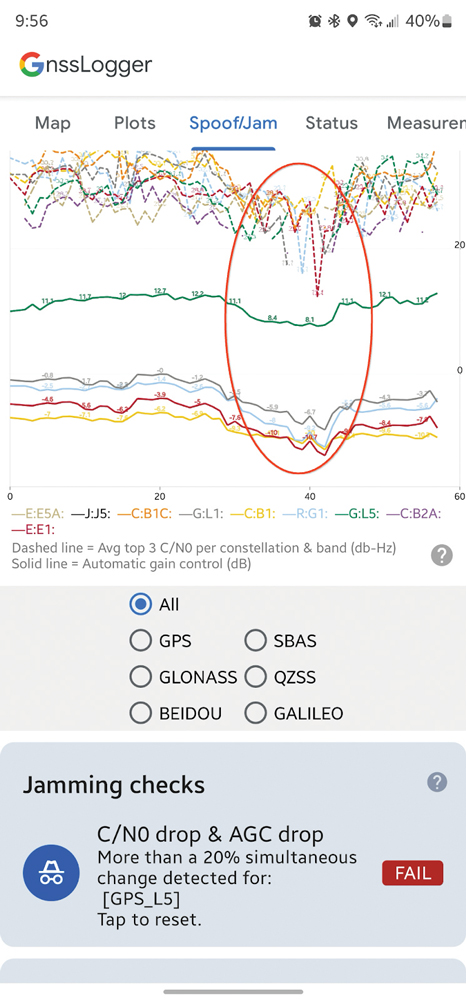
It is based on the fact that the carrier-to-noise ratio (C/No) of the signal as well as the automatic gain control (AGC) of the GNSS radio in the phone can be good indicators of interference. “The AGC tends to dip when spoofing or jamming is observed,” said Mohammed Khider, Ph.D., manager and senior staff software engineer at Google. However, he pointed out, for jamming events the C/N0 value drops while for spoofing it increases.
Making use of this effect, desktop tools that log data and analyze the AGC and C/No have long made it possible to detect interference. Now, Android users can do the same thing on their phones in real time, using the spoof/jam tab in Google’s GnssLogger app. It creates a graphic of AGC and C/No for each GNSS constellation and band. Moreover, the app cross checks the GNSS signals with other independent sources of information to flag potential jamming and interference. Below the real-time plot of AGC and C/N0 are a series of additional automated jamming and spoofing checks.
This is an experimental feature, and the algorithms behind it will be further improved as research progresses, Khider pointed out. Moreover, it will not catch all jamming or spoofing. However, it will make it much easier to examine data related to these GNSS interference events in real time.
Google launched its GnssLogger app in 2020, and it has been a leading tool for the GNSS community to better understand positioning and navigation on smartphones. “It helped establish a de-facto CSV (.txt) standard for raw measurements and other data for Android devices that has been used in many other tools, including Google’s own Gnss Analysis app,” said Khider.
Last fall, in addition to the new spoof/jam screen discussed above, Google also launched GnssLogger for Wear OS, a new companion app for Android smartwatches that offers several of the key features found in the phone app, and a new measurements screen, which enables users to view GNSS raw measurements in real time.
— Matteo Luccio, Editor-in-Chief