Listen to this content
Greenland is being twisted, compressed and stretched, according to researchers in the Department of Space Research and Space Technology of the Technical University of Denmark (DTU Space). As a result, the entire island has shifted northwest over the past 20 years by about 2 centimeters per year.
GNSS data shows plate tectonics and movements in the bedrock caused by the melting of large ice sheets, reducing pressure on the subsurface. The pressure is easing both because large amounts of ice have melted in Greenland in recent years, and because the bedrock is still affected by the enormous ice masses that have melted since the peak of the last Ice Age around 20,000 years ago.
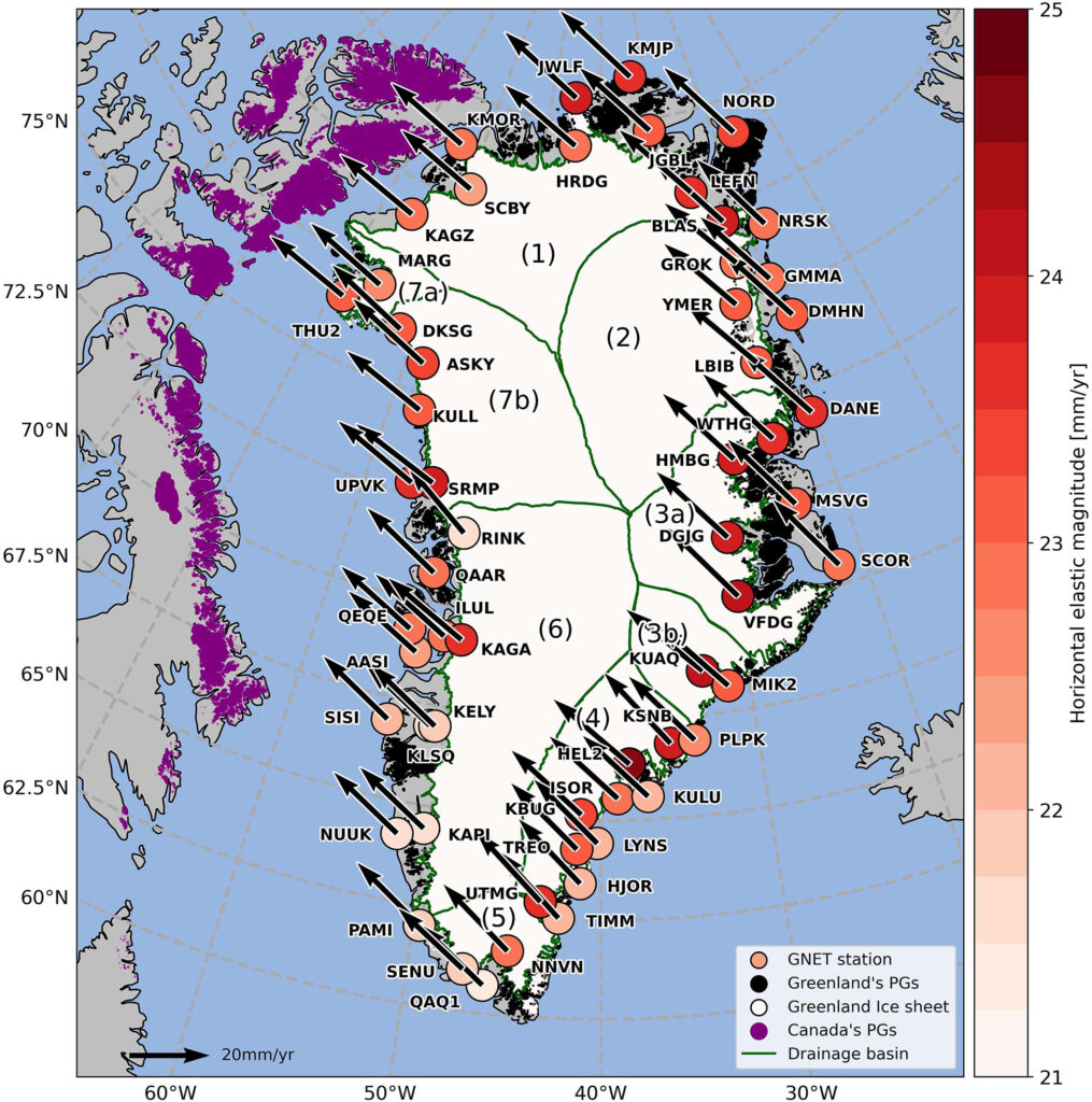
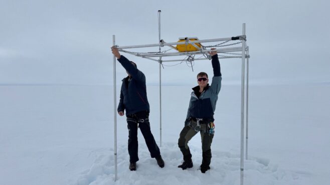
The new measurements are based on 58 GNSS stations placed around Greenland. They measure Greenland’s overall position, elevation changes in the bedrock, and how the island is shrinking and stretching. The movements are causing Greenland to both expand and contract horizontally. The effect is that Greenland’s area is currently being “stretched out” and becoming slightly larger in some regions, while others are being “pulled together.”
”Overall, this means Greenland is becoming slightly smaller, but that could change in the future with the accelerating melt we’re seeing now,” said DTU Space postdoc researcher Danjal Longfors Berg, lead author of the article in the Journal of Geophysical Research.
It is the first time the horizontal movements have been described in such detail.
”We have created a model that shows movements over a very long timescale from about 26,000 years ago to the present. At the same time, we have used very precise measurements from the past 20 years, which we use to analyze the current movements. This means we can now measure the movements very accurately,” Berg said.
Important for surveying and navigation
The new research provides useful information about what happens when climate change hits the Arctic with accelerating speed, as is the case in these years.
”It’s important to understand the movements of landmasses. They are of course interesting for geoscience. But they are also crucial for surveying and navigation, since even the fixed reference points in Greenland are slowly shifting,” Berg said.
The GNSS stations are owned by the Climate Data Authority under the Ministry of Climate, Energy and Utilities. They are used for research purposes and operated in collaboration with DTU Space. The research is conducted under the DTU Space research center Center for Ice-Sheet and Sea-Level Predictions (CISP).