No audio available for this content.
HawkEye 360 has made powerful enhancements to its GNSS Interference (GNSS-I) Detection product suite. The upgrades — designed with defense, intelligence and national security operations in mind — offer unprecedented accuracy, coverage and insight into global GPS jamming and spoofing threats.
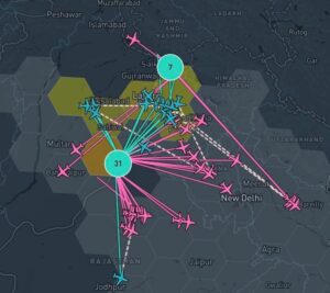
The update includes a new wider frequency algorithm that better distinguishes individual emitters, incorporates GPS spoofing detection, and is terrain adjusted for better geolocation accuracy, delivering greater situational awareness and more precise geolocation of interference sources worldwide.
HawkEye 360’s enhanced GNSS Interference Detection product suite supports strategic decision-making by providing timely, precise insight into potential signal disruptions, enabling stakeholders to better assess risk, respond confidently, and maintain operational continuity in dynamic environments.
With this release, HawkEye 360’s GNSS-I Detection product suite now provides:
- 15 times increase in geolocation density
- Spoofing detection and differentiation
- Terrain adjusted for increased accuracy
- Consistent monitoring across wide areas of interest
HawkEye 360’s new spoofing detection capability identifies potentially malicious transmitters that imitate legitimate GPS course/acquisition (PRN) codes — a tactic increasingly used to deceive aircraft and mislead navigation systems. The capability supports threat mitigation and trend analysis by detecting and geolocating these spoofers down to a kilometer-level precision.
“In contested environments, timely RF intelligence is the key to mission success,” said Alex Fox, president, International Business Unit. “Traditional land, sea, and air systems struggle in Anti-Access/Area Denial environments, while our satellites provide global GNSS-I detection and geolocation coverage. These enhanced capabilities give defense and intelligence teams the ability to identify and neutralize threats before they disrupt operations, enabling faster decisions and sharper visibility into adversary behavior.”


