Listen to this content
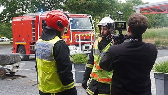
Syntony GNSS, the SDMIS of Lyon and CS-Group have released a demonstration video of the SubWAVE system, filmed at La Mine Bleue near Angers. The video highlights how GNSS signal emulation enables real-time tracking of first responders and victims in GPS-denied environments such as tunnels and mines. This advance allows for precise localization of responders and 112 emergency calls, while significantly enhancing tactical situational awareness during rescue operations.
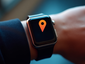
Emergencies that occur underground — in tunnels, mines, or parking garages — present a critical challenge to first responders: the inability to rely on GNSS signals. Satellite navigation systems cannot penetrate dense materials like concrete or rock, often leaving firefighters and rescue teams without essential positioning data. This lack of visibility can delay victim care and increase risks for responders who are already operating in complex, unfamiliar environments.
The SDMIS of Lyon, noted for its expertise in deep confined-space operations, recognized this operational barrier. In partnership with Syntony GNSS and CS-Group, they produced a demonstration of the SubWAVE system at La Mine Bleue, a tourist site near Angers, aiming to show how real-time GNSS signal emulation can improve safety and efficiency in underground rescue missions.
Central to this development is SubWAVE, a solution created by Syntony GNSS. Unlike GPS repeaters, which only retransmit surface signals underground, SubWAVE generates realistic GNSS signals in real time, including altitude data adapted to different underground layers. These signals are fully compatible with standard GNSS-enabled devices, ranging from professional radios to everyday smartphones. SubWAVE broadcasts these signals through antennas or existing underground radio infrastructure, ensuring a smooth transition between surface and subterranean environments. As a result, responders can be continuously tracked without requiring specialized equipment or recalibration.
The demonstration video clearly illustrates the system’s effectiveness. Firefighters equipped with radios or using the Réseau Radio du Futur (RRF) were tracked in real time, enabling commanding officers to coordinate operations with new levels of reliability.
With GNSS coverage and responder localization now possible underground, a wide range of advancements are within reach. It becomes feasible to locate victims or lone workers, even without active signal transmission, by utilizing GNSS capabilities in mobile phones. Guidance and alert systems can be integrated into helmets or masks for first responders, and artificial intelligence can help map and analyze intervention zones, anticipate hazards, and enhance situational awareness. The technology also allows for interoperability between fire, police and EMS services through shared geolocation data, and may expand precise localization capabilities to complex indoor environments such as shopping malls or high-rise buildings where GPS is often unreliable.
These improvements represent more than mere technical upgrades. They mark a fundamental shift in how emergency services can operate in GNSS-denied zones. By embedding intelligence and connectivity throughout the emergency response chain, SubWAVE aims to redefine standards of safety and coordination in some of the most challenging rescue scenarios.