Listen to this content
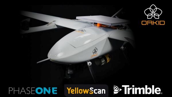
Drone-maker Orkid has unveiled a new variant of its Orkid 260 drone that incorporates four technologies to improve aerial data-capture technology.
According to the company, the Orkid 260VTOL represents a leap forward in the integration of advanced sensing and communication technologies, setting a new benchmark for multi-mission drone capability across commercial and industrial applications. The company said it is the “first vertical take-off and landing (VTOL) drone to bring all four of the most advanced aerial data capture technologies together — onboard, fully integrated, and operating simultaneously.”
The system combines lidar (YellowScan Surveyor Ultra), photogrammetry (Phase One P5 camera), GNSS/IMU (Trimble Applanix APX-RTX), and Starlink satellite communications integration in a single platform.
Built on a 100% electric, NDAA-compliant architecture, the aircraft delivers an estimated 1.5 hours of flight endurance with a range of up to 75 miles. Designed for mapping, surveying, utilities, oil and gas, defense, and critical infrastructure inspection, the new model expands the operational scope for high-precision, long-range missions.