Listen to this content
A team of researchers at Q-CTRL, a quantum infrastructure software company based in Sydney, Australia, has completed a successful demonstration of a new quantum navigation system called Ironstone Opal. The group described the system’s operation and performance in a paper posted to the arXiv preprint server.
GPS technology is widely used for navigation in both civilian and military vehicles and aircraft. However, the increasing reliance on GPS has highlighted its vulnerability to outages, which can leave drivers stranded, force pilots to rely on outdated methods and complicate the deployment of military assets. These concerns have driven efforts worldwide to develop robust backup systems or alternatives to GPS.
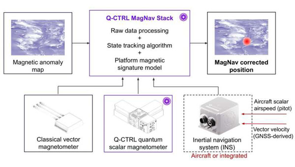
Q-CTRL’s Ironstone Opal is designed as a backup navigation system and, according to the research team, can deliver accuracy up to 50 times greater than existing GPS backup systems in certain scenarios. The system leverages quantum sensors that are highly sensitive to variations in the Earth’s magnetic field. Because the magnetic field differs depending on geographic location, these sensors can precisely determine an object’s position by reading the field and using artificial intelligence-based software to generate geographic coordinates similar to those provided by GPS.
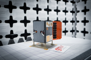
The research team shared that unlike conventional systems, Ironstone Opal is passive, meaning it does not emit signals that could be detected or jammed by adversaries. The system’s software is designed to filter out noise from vehicles or aircraft carrying the sensors, and the hardware is compact enough for installation in cars, trucks, UAVs and aircraft.
Field trials conducted by Q-CTRL included both ground vehicles and aircraft. The results showed that Ironstone Opal outperformed a high-end inertial navigation system, a standard GPS backup, by up to 50 times in ground tests and by at least 11 times in airborne tests. These trials demonstrated the system’s ability to maintain high accuracy under a range of environmental conditions, altitudes, and maneuvers, with positioning uncertainty as low as 0.01% of the total distance traveled in the best cases.
Q-CTRL’s approach combines proprietary quantum magnetometers with advanced denoising and map-matching software, allowing the system to detect subtle magnetic “landmarks” in the Earth’s structure. The technology is designed to be resilient, unjammable, and suitable for integration into a wide range of platforms, including autonomous vehicles and commercial aircraft.