Trust your position
If it drives, flies or floats, our tailored positioning solutions get you moving in the right direction.
Trimble Applanix, a division of Trimble Inc., is a leading provider of advanced positioning and orientation solutions for various applications. With a strong focus on precision, reliability, and innovation, Trimble Applanix has firmly established itself as a leader in the geospatial industry. Here, we delve into the various solutions and products offered by Trimble Applanix, highlighting their significance and impact on different sectors.
Overview of Trimble Applanix
Founded in 1991, Applanix was acquired by Trimble in 2003, combining Applanix’s expertise in inertial navigation systems (INS) with Trimble’s advanced GPS technology. This synergy has resulted in the development of cutting-edge solutions that cater to the needs of professionals in surveying, mapping, and navigation.
Core Technologies
At the heart of Trimble Applanix’s offerings are two core technologies: Global Navigation Satellite System (GNSS) and Inertial Navigation System (INS). GNSS provides accurate positioning data by utilizing signals from multiple satellite constellations, while INS offers precise orientation and motion data through accelerometers and gyroscopes. By integrating these technologies, Trimble Applanix delivers solutions that ensure high accuracy and reliability, even in challenging environments.
Direct Georeferencing (DG)
Direct Georeferencing (DG) eliminates the need for ground control points (GCPs) in aerial and mobile mapping applications. By integrating GNSS and INS data, DG enables the direct georeferencing of sensor data, resulting in significant time and cost savings. DG is particularly beneficial for large-scale mapping projects, where establishing GCPs can be time-consuming and expensive. It is also
widely used in corridor mapping, forestry, agriculture, and many more industries.
Key Solutions and Products
Trimble Applanix offers a range of direct georeferencing solutions for OEMs and end-users to meet the diverse needs of the mobile mapping industry. These products leverage advanced GNSS and INS
technologies to deliver high-precision positioning and orientation solutions.
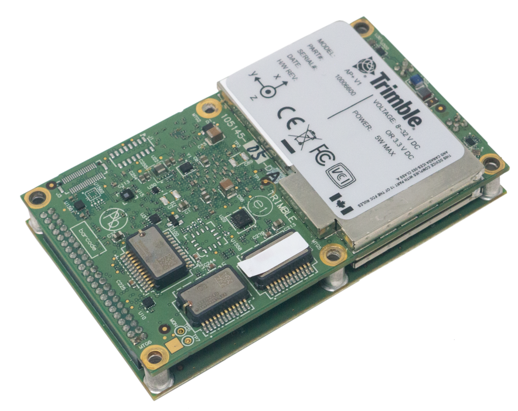
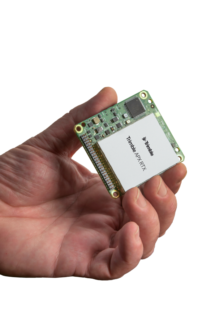
OEM Products
Trimble Applanix’s OEM products are designed for seamless integration into custom systems and applications. These products include the AP+ and APX RTX series, which provide high-accuracy
GNSS-Inertial solutions for various platforms, including UAVs, land vehicles, and marine vessels. The OEM modules are compact, lightweight, and versatile, making them ideal for integration into
specialized equipment. They offer precise data collection in even very challenging environments.
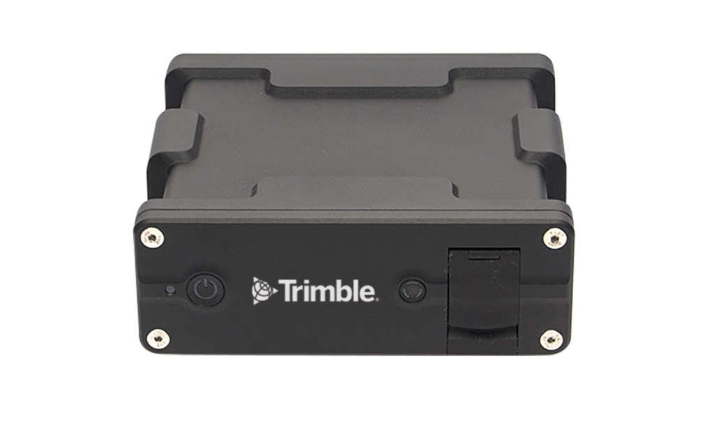
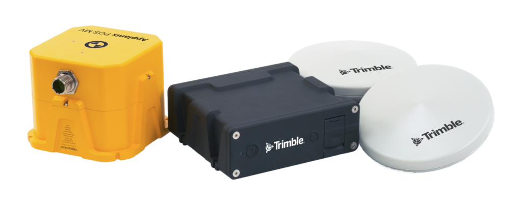
End User Products
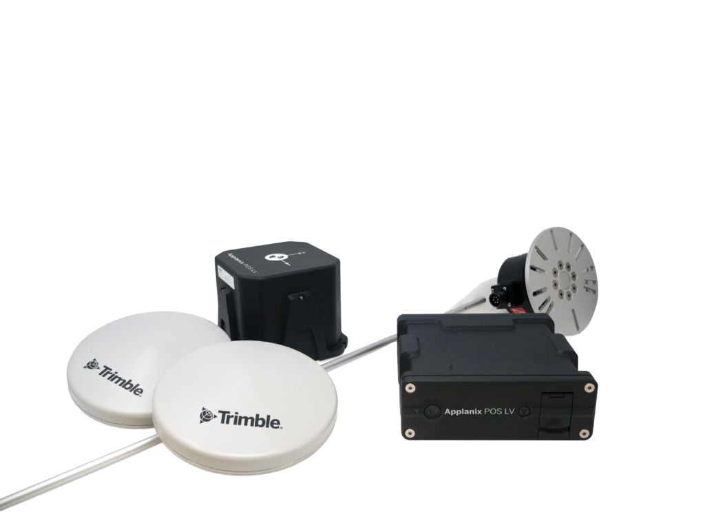
The boxed products from Trimble Applanix are complete, ready-to-use solutions that cater to specific applications. Key products include the POS AV, POS LV, and POS MV systems.
Applanix POS AV: Designed for airborne mapping, this system integrates GNSS and INS to provide accurate position and orientation data for aerial platforms. It is essential for generating high-quality geospatial information, such as orthophotos and 3D point clouds.
Applanix POS LV: This system, tailored for land-based mobile mapping, combines GNSS and INS to deliver precise data for vehicles equipped with mapping sensors. It is widely used in applications such as autonomous vehicle navigation and urban planning.
Applanix POS MV: Developed for marine applications, this system provides accurate positioning and orientation for vessels, crucial for hydrographic surveying and offshore construction.
Trimble Applanix’s products are trusted by professionals worldwide for their reliability, accuracy, and ease of integration. They are indispensable tools in the geospatial industry.
Applications and Impact
Trimble Applanix’s solutions profoundly impact various sectors, enabling professionals to achieve higher accuracy, efficiency, and productivity. Some of the key applications include: Surveying and Mapping: Trimble Applanix’s solutions create accurate and detailed maps for various applications, including land development, infrastructure planning, and environmental monitoring. Autonomous Vehicles: Trimble Applanix’s systems provide high-precision positioning and orientation data, essential for the safe
and reliable operation of autonomous vehicles, including self-driving cars and drones.
Marine Applications: Trimble Applanix’s marine solutions are used for hydrographic surveying, offshore construction, and maritime safety, ensuring accurate and reliable data in challenging marine environments.
Disaster Management: Trimble Applanix’s solutions generate accurate geospatial data for disaster response and recovery, enabling authorities to make informed decisions and allocate resources
effectively.
Conclusion
Trimble Applanix continues to push the boundaries of geospatial technology, delivering innovative solutions that meet the evolving needs of professionals in various industries. By combining GNSS and
INS technologies, Trimble Applanix ensures high accuracy, reliability, and efficiency in its products, making it a trusted partner for organizations worldwide. As the demand for precise geospatial data continues to grow, Trimble Applanix remains at the forefront of the industry, driving advancements and shaping the future of geospatial solutions.
For more information on Trimble Applanix and their products, visit
https://applanix.trimble.com/en