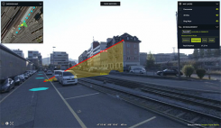
Hexagon Geospatial updates platform for location intelligence
October 22, 2020
Luciad 2020.1 features dynamic panoramic imagery capabilities and immersive 3D imagery Hexagon’s Geospatial division has launched Luciad 2020.1, a […]
Read More
Luciad 2020.1 features dynamic panoramic imagery capabilities and immersive 3D imagery Hexagon’s Geospatial division has launched Luciad 2020.1, a […]
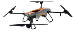
Lidar series paired with professional drone provides multi-platform, high-accuracy 3D laser scanning for geospatial and mapping professionals CHC […]
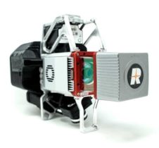
GeoCue Group has released the True View 615 and True View 620 UAS lidar 3D imaging systems. The […]

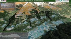
At the 2019 Esri User Conference in San Diego, Nearmap’s Tony Agresta discusses Nearmap 3D, which allows customers […]
Hexagon’s Geospatial Division launched M.App Enterprise 2019 at its user conference, HxGN LIVE 2019. The latest version of M.App […]

Aerial imagery business Nearmap has launched its new 3D product to streamline the way industries such as urban planning, architecture, construction, […]
Topcon Positioning Group has introduced software to facilitate the data-processing workflow for UAV (unmanned aerial vehicle) infrastructure inspection. […]
Bentley Systems, a global provider of comprehensive software solutions for advancing infrastructure, has acquired Plaxis, provider of geotechnical software, based in […]


Follow Us